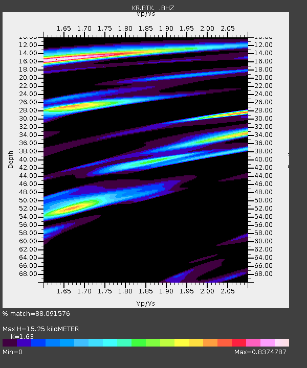
BTK Batken, Kyrgyzstan - Earthquake Result Viewer

Earthquake location: Near East Coast Of Honshu, Japan
Earthquake latitude/longitude: 37.4/141.4
Earthquake time(UTC): 2011/11/23 (327) 19:24:31 GMT
Earthquake Depth: 34 km
Earthquake Magnitude: 5.7 MB, 5.8 MS, 6.1 MW, 6.1 MW
Earthquake Catalog/Contributor: WHDF/NEIC
Network: KR Kyrgyz Digital Network
Station: BTK Batken, Kyrgyzstan
Lat/Lon: 40.06 N/70.82 E
Elevation: 1020 m
Distance: 53.8 deg
Az: 296.211 deg
Baz: 68.644 deg
Ray Param: 0.06581094
Estimated Moho Depth: 15.25 km
Estimated Crust Vp/Vs: 1.63
Assumed Crust Vp: 6.236 km/s
Estimated Crust Vs: 3.826 km/s
Estimated Crust Poisson's Ratio: 0.20
Radial Match: 88.091576 %
Radial Bump: 400
Transverse Match: 84.8297 %
Transverse Bump: 400
SOD ConfigId: 432046
Insert Time: 2012-03-03 06:33:48.933 +0000
GWidth: 2.5
Max Bumps: 400
Tol: 0.001

Signal To Noise

ChannelStoNSTALTA
KR:BTK: :BHZ:20111123T19:33:19.899993Z11.7006061.1508247E-69.835599E-8
KR:BTK: :BHN:20111123T19:33:19.899993Z2.48352482.0425463E-78.224385E-8
KR:BTK: :BHE:20111123T19:33:19.899993Z5.4662515.127569E-79.380413E-8
Arrivals
Ps1.6 SECOND
PpPs6.1 SECOND
PsPs/PpSs7.7 SECOND