You are here: Home > Network List > TA - USArray Transportable Network (new EarthScope stations) Stations List
> Station N34A Lincoln, NE, USA > Earthquake Result Viewer
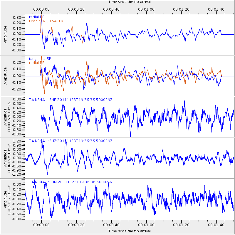
N34A Lincoln, NE, USA - Earthquake Result Viewer
*The percent match for this event was below the threshold and hence no stack was calculated.
| Earthquake location: |
Near East Coast Of Honshu, Japan |
| Earthquake latitude/longitude: |
37.4/141.4 |
| Earthquake time(UTC): |
2011/11/23 (327) 19:24:31 GMT |
| Earthquake Depth: |
34 km |
| Earthquake Magnitude: |
5.7 MB, 5.8 MS, 6.1 MW, 6.1 MW |
| Earthquake Catalog/Contributor: |
WHDF/NEIC |
|
| Network: |
TA USArray Transportable Network (new EarthScope stations) |
| Station: |
N34A Lincoln, NE, USA |
| Lat/Lon: |
40.84 N/96.50 W |
| Elevation: |
401 m |
|
| Distance: |
85.9 deg |
| Az: |
40.105 deg |
| Baz: |
317.432 deg |
| Ray Param: |
$rayparam |
*The percent match for this event was below the threshold and hence was not used in the summary stack. |
|
| Radial Match: |
61.180943 % |
| Radial Bump: |
400 |
| Transverse Match: |
64.719986 % |
| Transverse Bump: |
400 |
| SOD ConfigId: |
432046 |
| Insert Time: |
2012-03-03 06:39:24.117 +0000 |
| GWidth: |
2.5 |
| Max Bumps: |
400 |
| Tol: |
0.001 |
|
Signal To Noise
| Channel | StoN | STA | LTA |
| TA:N34A: :BHZ:20111123T19:36:36.500029Z | 2.8620834 | 7.115227E-7 | 2.4860304E-7 |
| TA:N34A: :BHN:20111123T19:36:36.500029Z | 2.2148173 | 4.594134E-7 | 2.0742722E-7 |
| TA:N34A: :BHE:20111123T19:36:36.500029Z | 0.8217703 | 2.5691568E-7 | 3.1263687E-7 |
| Arrivals |
| Ps | |
| PpPs | |
| PsPs/PpSs | |


