You are here: Home > Network List > TA - USArray Transportable Network (new EarthScope stations) Stations List
> Station M37A Trindle Farm, Earlham, IA, USA > Earthquake Result Viewer
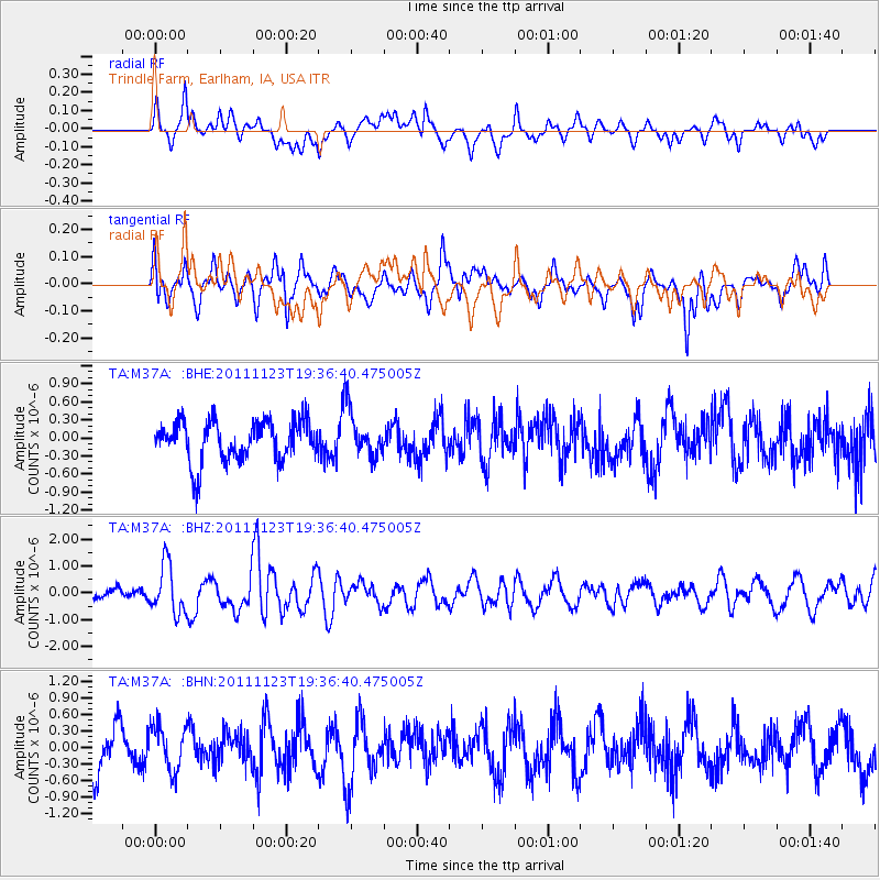
M37A Trindle Farm, Earlham, IA, USA - Earthquake Result Viewer
*The percent match for this event was below the threshold and hence no stack was calculated.
| Earthquake location: |
Near East Coast Of Honshu, Japan |
| Earthquake latitude/longitude: |
37.4/141.4 |
| Earthquake time(UTC): |
2011/11/23 (327) 19:24:31 GMT |
| Earthquake Depth: |
34 km |
| Earthquake Magnitude: |
5.7 MB, 5.8 MS, 6.1 MW, 6.1 MW |
| Earthquake Catalog/Contributor: |
WHDF/NEIC |
|
| Network: |
TA USArray Transportable Network (new EarthScope stations) |
| Station: |
M37A Trindle Farm, Earlham, IA, USA |
| Lat/Lon: |
41.40 N/94.06 W |
| Elevation: |
325 m |
|
| Distance: |
86.7 deg |
| Az: |
38.35 deg |
| Baz: |
318.918 deg |
| Ray Param: |
$rayparam |
*The percent match for this event was below the threshold and hence was not used in the summary stack. |
|
| Radial Match: |
67.833595 % |
| Radial Bump: |
400 |
| Transverse Match: |
54.876526 % |
| Transverse Bump: |
400 |
| SOD ConfigId: |
432046 |
| Insert Time: |
2012-03-03 06:44:15.077 +0000 |
| GWidth: |
2.5 |
| Max Bumps: |
400 |
| Tol: |
0.001 |
|
Signal To Noise
| Channel | StoN | STA | LTA |
| TA:M37A: :BHZ:20111123T19:36:40.475005Z | 3.4438674 | 9.0897754E-7 | 2.6394093E-7 |
| TA:M37A: :BHN:20111123T19:36:40.475005Z | 1.077803 | 3.956739E-7 | 3.671115E-7 |
| TA:M37A: :BHE:20111123T19:36:40.475005Z | 1.164855 | 3.9087985E-7 | 3.3556094E-7 |
| Arrivals |
| Ps | |
| PpPs | |
| PsPs/PpSs | |


