You are here: Home > Network List > TA - USArray Transportable Network (new EarthScope stations) Stations List
> Station L39A Vinton, IA, USA > Earthquake Result Viewer
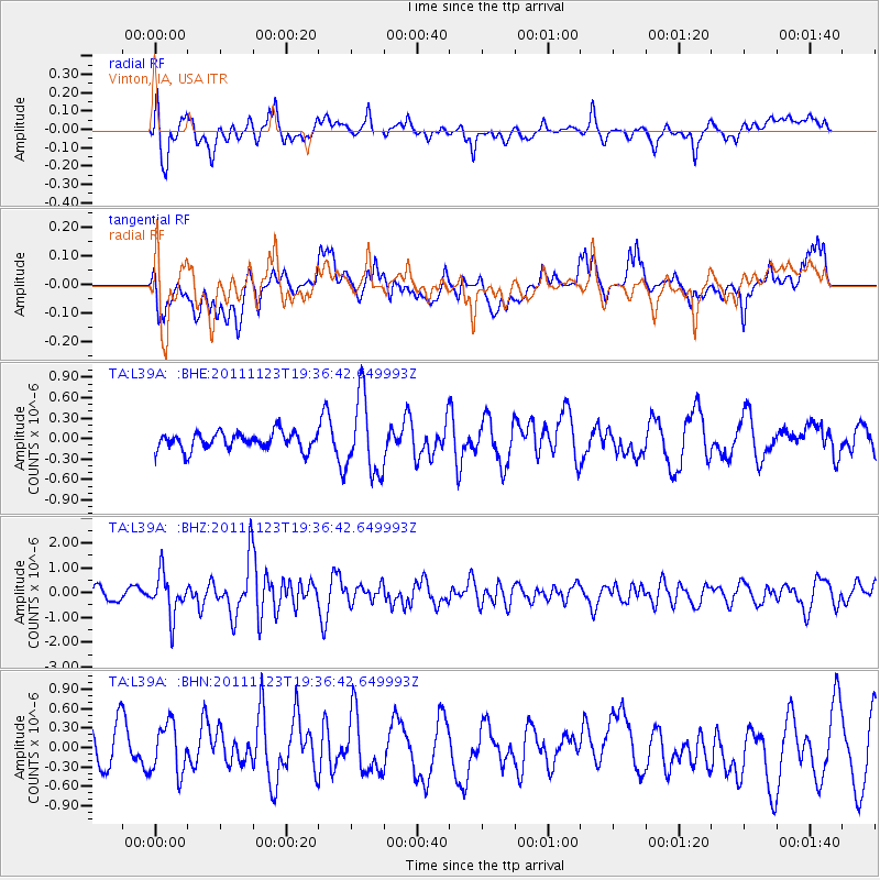
L39A Vinton, IA, USA - Earthquake Result Viewer
*The percent match for this event was below the threshold and hence no stack was calculated.
| Earthquake location: |
Near East Coast Of Honshu, Japan |
| Earthquake latitude/longitude: |
37.4/141.4 |
| Earthquake time(UTC): |
2011/11/23 (327) 19:24:31 GMT |
| Earthquake Depth: |
34 km |
| Earthquake Magnitude: |
5.7 MB, 5.8 MS, 6.1 MW, 6.1 MW |
| Earthquake Catalog/Contributor: |
WHDF/NEIC |
|
| Network: |
TA USArray Transportable Network (new EarthScope stations) |
| Station: |
L39A Vinton, IA, USA |
| Lat/Lon: |
42.12 N/92.00 W |
| Elevation: |
261 m |
|
| Distance: |
87.1 deg |
| Az: |
36.709 deg |
| Baz: |
320.194 deg |
| Ray Param: |
$rayparam |
*The percent match for this event was below the threshold and hence was not used in the summary stack. |
|
| Radial Match: |
67.53496 % |
| Radial Bump: |
400 |
| Transverse Match: |
46.478107 % |
| Transverse Bump: |
400 |
| SOD ConfigId: |
432046 |
| Insert Time: |
2012-03-03 06:48:30.460 +0000 |
| GWidth: |
2.5 |
| Max Bumps: |
400 |
| Tol: |
0.001 |
|
Signal To Noise
| Channel | StoN | STA | LTA |
| TA:L39A: :BHZ:20111123T19:36:42.649993Z | 3.9275894 | 8.240133E-7 | 2.0980127E-7 |
| TA:L39A: :BHN:20111123T19:36:42.649993Z | 1.5538284 | 3.949416E-7 | 2.5417324E-7 |
| TA:L39A: :BHE:20111123T19:36:42.649993Z | 4.4503784 | 5.5860414E-7 | 1.2551835E-7 |
| Arrivals |
| Ps | |
| PpPs | |
| PsPs/PpSs | |


