HYB Hyderabad, India - Earthquake Result Viewer
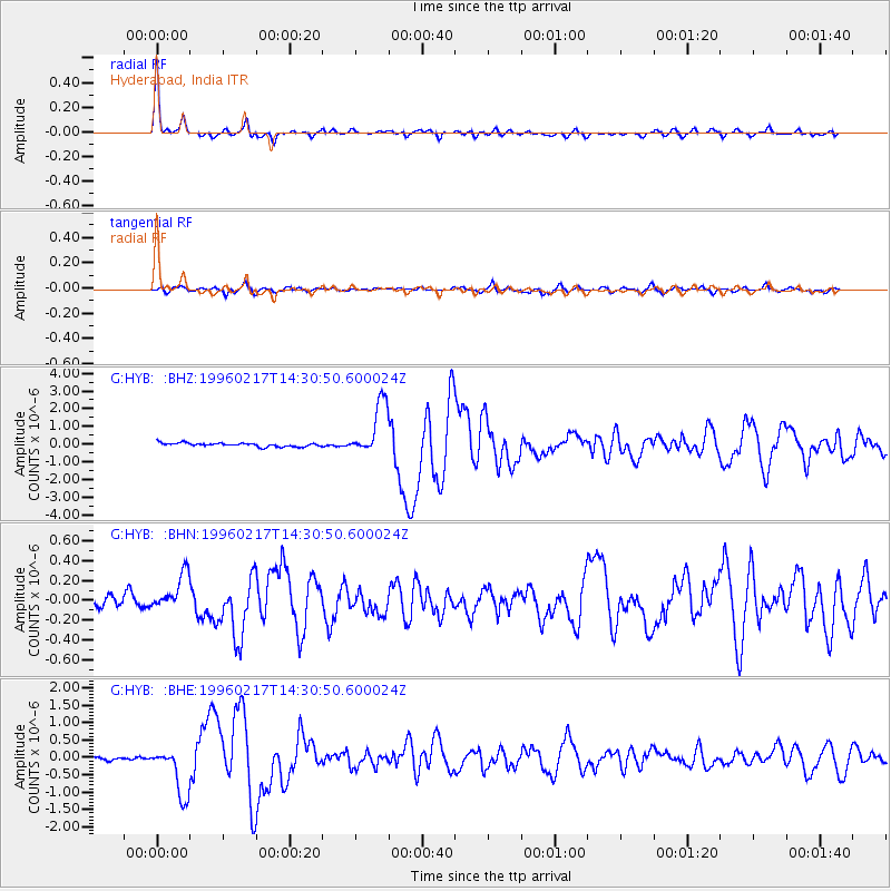
Earthquake location: Irian Jaya Region, Indonesia
Earthquake latitude/longitude: -0.6/135.9
Earthquake time(UTC): 1996/02/17 (048) 14:21:23 GMT
Earthquake Depth: 33 km
Earthquake Magnitude: 5.8 MB, 6.7 MS, 6.7 UNKNOWN, 6.4 MW
Earthquake Catalog/Contributor: WHDF/NEIC
Network: G GEOSCOPE
Station: HYB Hyderabad, India
Lat/Lon: 17.42 N/78.55 E
Elevation: 510 m
Distance: 59.2 deg
Az: 290.644 deg
Baz: 101.445 deg
Ray Param: 0.06230437
Estimated Moho Depth: 33.5 km
Estimated Crust Vp/Vs: 1.75
Assumed Crust Vp: 6.459 km/s
Estimated Crust Vs: 3.681 km/s
Estimated Crust Poisson's Ratio: 0.26
Radial Match: 95.3545 %
Radial Bump: 264
Transverse Match: 83.250916 %
Transverse Bump: 400
SOD ConfigId: 6273
Insert Time: 2010-02-26 22:53:45.934 +0000
GWidth: 2.5
Max Bumps: 400
Tol: 0.001

Signal To Noise

ChannelStoNSTALTA
G:HYB: :BHN:19960217T14:30:50.600024Z3.62025711.8178918E-75.021444E-8
G:HYB: :BHE:19960217T14:30:50.600024Z17.7928717.169677E-74.029522E-8
G:HYB: :BHZ:19960217T14:30:50.600024Z14.9122751.5220375E-61.02066075E-7
Arrivals
Ps4.1 SECOND
PpPs14 SECOND
PsPs/PpSs18 SECOND