HYB Hyderabad, India - Earthquake Result Viewer
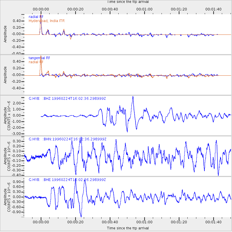
Earthquake location: Irian Jaya Region, Indonesia
Earthquake latitude/longitude: -0.9/137.3
Earthquake time(UTC): 1996/02/24 (055) 15:52:59 GMT
Earthquake Depth: 33 km
Earthquake Magnitude: 5.6 MB, 5.9 MS, 6.2 UNKNOWN, 6.2 MW
Earthquake Catalog/Contributor: WHDF/NEIC
Network: G GEOSCOPE
Station: HYB Hyderabad, India
Lat/Lon: 17.42 N/78.55 E
Elevation: 510 m
Distance: 60.7 deg
Az: 290.493 deg
Baz: 101.181 deg
Ray Param: 0.06132639
Estimated Moho Depth: 31.5 km
Estimated Crust Vp/Vs: 1.86
Assumed Crust Vp: 6.459 km/s
Estimated Crust Vs: 3.478 km/s
Estimated Crust Poisson's Ratio: 0.30
Radial Match: 95.22713 %
Radial Bump: 320
Transverse Match: 84.10468 %
Transverse Bump: 400
SOD ConfigId: 6273
Insert Time: 2010-02-26 22:53:53.512 +0000
GWidth: 2.5
Max Bumps: 400
Tol: 0.001

Signal To Noise

ChannelStoNSTALTA
G:HYB: :BHN:19960224T16:02:36.298999Z1.51224026.3994065E-84.2317396E-8
G:HYB: :BHE:19960224T16:02:36.298999Z5.26069162.3171143E-74.4045812E-8
G:HYB: :BHZ:19960224T16:02:36.298999Z6.7534415.26331E-77.793523E-8
Arrivals
Ps4.4 SECOND
PpPs13 SECOND
PsPs/PpSs18 SECOND