You are here: Home > Network List > CI - Caltech Regional Seismic Network Stations List
> Station FUR Furnace Creek, CA, USA > Earthquake Result Viewer
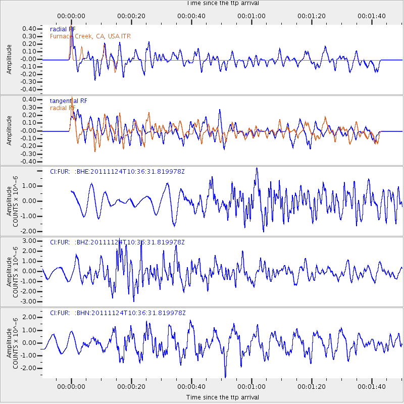
FUR Furnace Creek, CA, USA - Earthquake Result Viewer
*The percent match for this event was below the threshold and hence no stack was calculated.
| Earthquake location: |
Hokkaido, Japan Region |
| Earthquake latitude/longitude: |
41.9/142.6 |
| Earthquake time(UTC): |
2011/11/24 (328) 10:25:34 GMT |
| Earthquake Depth: |
38 km |
| Earthquake Magnitude: |
5.9 MB, 5.8 MS, 6.2 MW, 6.2 MW |
| Earthquake Catalog/Contributor: |
WHDF/NEIC |
|
| Network: |
CI Caltech Regional Seismic Network |
| Station: |
FUR Furnace Creek, CA, USA |
| Lat/Lon: |
36.47 N/116.86 W |
| Elevation: |
-37.0 m |
|
| Distance: |
73.5 deg |
| Az: |
55.758 deg |
| Baz: |
310.039 deg |
| Ray Param: |
$rayparam |
*The percent match for this event was below the threshold and hence was not used in the summary stack. |
|
| Radial Match: |
61.8375 % |
| Radial Bump: |
400 |
| Transverse Match: |
57.41754 % |
| Transverse Bump: |
400 |
| SOD ConfigId: |
432046 |
| Insert Time: |
2012-03-03 07:00:05.038 +0000 |
| GWidth: |
2.5 |
| Max Bumps: |
400 |
| Tol: |
0.001 |
|
Signal To Noise
| Channel | StoN | STA | LTA |
| CI:FUR: :BHZ:20111124T10:36:31.819978Z | 3.2806127 | 8.5856846E-7 | 2.6170977E-7 |
| CI:FUR: :BHN:20111124T10:36:31.819978Z | 0.7204328 | 5.6868964E-7 | 7.893722E-7 |
| CI:FUR: :BHE:20111124T10:36:31.819978Z | 1.8890121 | 9.158558E-7 | 4.848332E-7 |
| Arrivals |
| Ps | |
| PpPs | |
| PsPs/PpSs | |


