You are here: Home > Network List > TA - USArray Transportable Network (new EarthScope stations) Stations List
> Station A04D Lummi Island, WA, USA > Earthquake Result Viewer
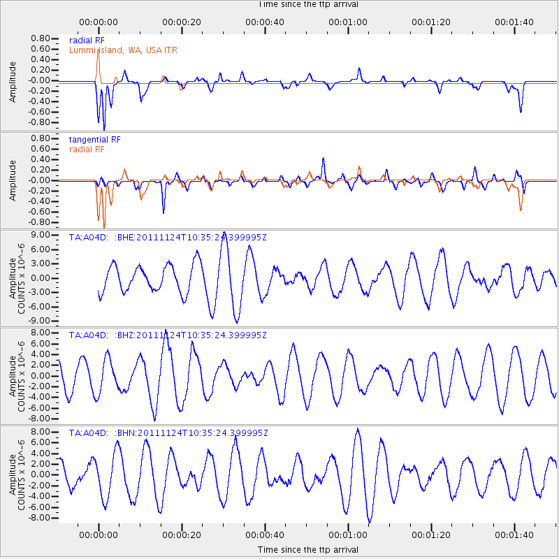
A04D Lummi Island, WA, USA - Earthquake Result Viewer
*The percent match for this event was below the threshold and hence no stack was calculated.
| Earthquake location: |
Hokkaido, Japan Region |
| Earthquake latitude/longitude: |
41.9/142.6 |
| Earthquake time(UTC): |
2011/11/24 (328) 10:25:34 GMT |
| Earthquake Depth: |
38 km |
| Earthquake Magnitude: |
5.9 MB, 5.8 MS, 6.2 MW, 6.2 MW |
| Earthquake Catalog/Contributor: |
WHDF/NEIC |
|
| Network: |
TA USArray Transportable Network (new EarthScope stations) |
| Station: |
A04D Lummi Island, WA, USA |
| Lat/Lon: |
48.72 N/122.71 W |
| Elevation: |
13 m |
|
| Distance: |
62.7 deg |
| Az: |
47.96 deg |
| Baz: |
303.15 deg |
| Ray Param: |
$rayparam |
*The percent match for this event was below the threshold and hence was not used in the summary stack. |
|
| Radial Match: |
65.40316 % |
| Radial Bump: |
400 |
| Transverse Match: |
75.91685 % |
| Transverse Bump: |
348 |
| SOD ConfigId: |
432046 |
| Insert Time: |
2012-03-03 07:15:10.103 +0000 |
| GWidth: |
2.5 |
| Max Bumps: |
400 |
| Tol: |
0.001 |
|
Signal To Noise
| Channel | StoN | STA | LTA |
| TA:A04D: :BHZ:20111124T10:35:24.399995Z | 1.8338618 | 3.1976672E-6 | 1.7436794E-6 |
| TA:A04D: :BHN:20111124T10:35:24.399995Z | 2.1679037 | 4.1673525E-6 | 1.9222962E-6 |
| TA:A04D: :BHE:20111124T10:35:24.399995Z | 2.435279 | 6.7531237E-6 | 2.773039E-6 |
| Arrivals |
| Ps | |
| PpPs | |
| PsPs/PpSs | |


