You are here: Home > Network List > TA - USArray Transportable Network (new EarthScope stations) Stations List
> Station W41B Gary Mavity, Velonia, AR, USA > Earthquake Result Viewer
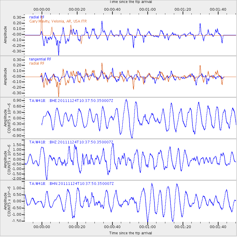
W41B Gary Mavity, Velonia, AR, USA - Earthquake Result Viewer
*The percent match for this event was below the threshold and hence no stack was calculated.
| Earthquake location: |
Hokkaido, Japan Region |
| Earthquake latitude/longitude: |
41.9/142.6 |
| Earthquake time(UTC): |
2011/11/24 (328) 10:25:34 GMT |
| Earthquake Depth: |
38 km |
| Earthquake Magnitude: |
5.9 MB, 5.8 MS, 6.2 MW, 6.2 MW |
| Earthquake Catalog/Contributor: |
WHDF/NEIC |
|
| Network: |
TA USArray Transportable Network (new EarthScope stations) |
| Station: |
W41B Gary Mavity, Velonia, AR, USA |
| Lat/Lon: |
35.17 N/92.25 W |
| Elevation: |
95 m |
|
| Distance: |
88.3 deg |
| Az: |
42.101 deg |
| Baz: |
322.34 deg |
| Ray Param: |
$rayparam |
*The percent match for this event was below the threshold and hence was not used in the summary stack. |
|
| Radial Match: |
64.52831 % |
| Radial Bump: |
396 |
| Transverse Match: |
68.57867 % |
| Transverse Bump: |
400 |
| SOD ConfigId: |
432046 |
| Insert Time: |
2012-03-03 07:18:06.319 +0000 |
| GWidth: |
2.5 |
| Max Bumps: |
400 |
| Tol: |
0.001 |
|
Signal To Noise
| Channel | StoN | STA | LTA |
| TA:W41B: :BHZ:20111124T10:37:50.350007Z | 2.8594303 | 1.0976141E-6 | 3.838576E-7 |
| TA:W41B: :BHN:20111124T10:37:50.350007Z | 0.9335606 | 3.9004075E-7 | 4.1779907E-7 |
| TA:W41B: :BHE:20111124T10:37:50.350007Z | 1.1698836 | 3.4473302E-7 | 2.9467293E-7 |
| Arrivals |
| Ps | |
| PpPs | |
| PsPs/PpSs | |


