You are here: Home > Network List > TA - USArray Transportable Network (new EarthScope stations) Stations List
> Station U44A Portageville, MO, USA > Earthquake Result Viewer
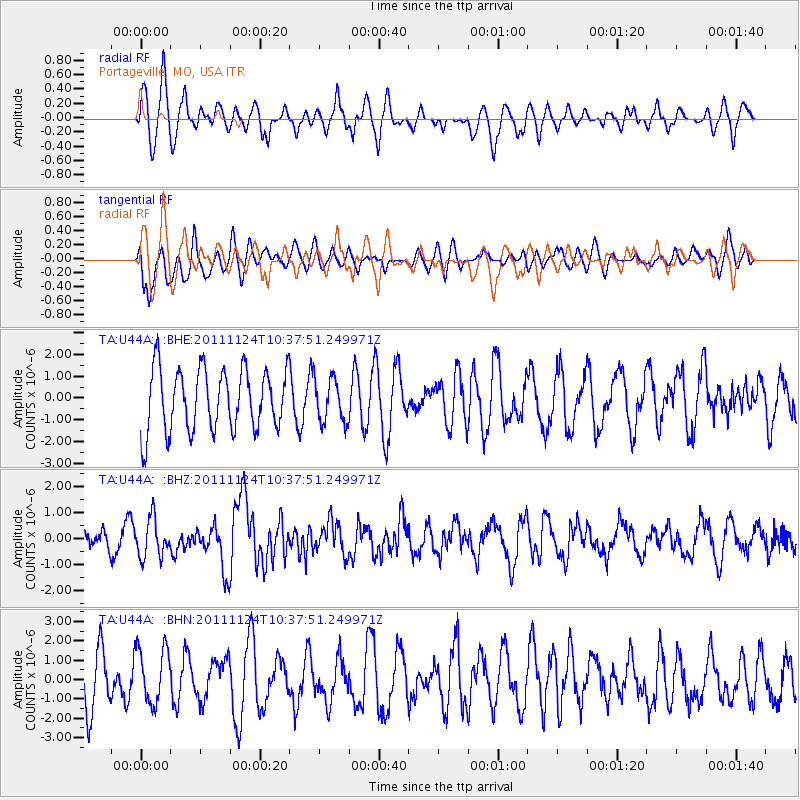
U44A Portageville, MO, USA - Earthquake Result Viewer
*The percent match for this event was below the threshold and hence no stack was calculated.
| Earthquake location: |
Hokkaido, Japan Region |
| Earthquake latitude/longitude: |
41.9/142.6 |
| Earthquake time(UTC): |
2011/11/24 (328) 10:25:34 GMT |
| Earthquake Depth: |
38 km |
| Earthquake Magnitude: |
5.9 MB, 5.8 MS, 6.2 MW, 6.2 MW |
| Earthquake Catalog/Contributor: |
WHDF/NEIC |
|
| Network: |
TA USArray Transportable Network (new EarthScope stations) |
| Station: |
U44A Portageville, MO, USA |
| Lat/Lon: |
36.50 N/89.69 W |
| Elevation: |
89 m |
|
| Distance: |
88.5 deg |
| Az: |
39.638 deg |
| Baz: |
323.765 deg |
| Ray Param: |
$rayparam |
*The percent match for this event was below the threshold and hence was not used in the summary stack. |
|
| Radial Match: |
60.639454 % |
| Radial Bump: |
400 |
| Transverse Match: |
50.5435 % |
| Transverse Bump: |
400 |
| SOD ConfigId: |
432046 |
| Insert Time: |
2012-03-03 07:20:11.408 +0000 |
| GWidth: |
2.5 |
| Max Bumps: |
400 |
| Tol: |
0.001 |
|
Signal To Noise
| Channel | StoN | STA | LTA |
| TA:U44A: :BHZ:20111124T10:37:51.249971Z | 1.9181647 | 7.3535153E-7 | 3.8336205E-7 |
| TA:U44A: :BHN:20111124T10:37:51.249971Z | 1.2970035 | 1.4389419E-6 | 1.1094357E-6 |
| TA:U44A: :BHE:20111124T10:37:51.249971Z | 0.7002529 | 9.959924E-7 | 1.4223325E-6 |
| Arrivals |
| Ps | |
| PpPs | |
| PsPs/PpSs | |


