You are here: Home > Network List > G - GEOSCOPE Stations List
> Station FOMA Nahampoana reservation, Fort Dauphin, Madagascar > Earthquake Result Viewer
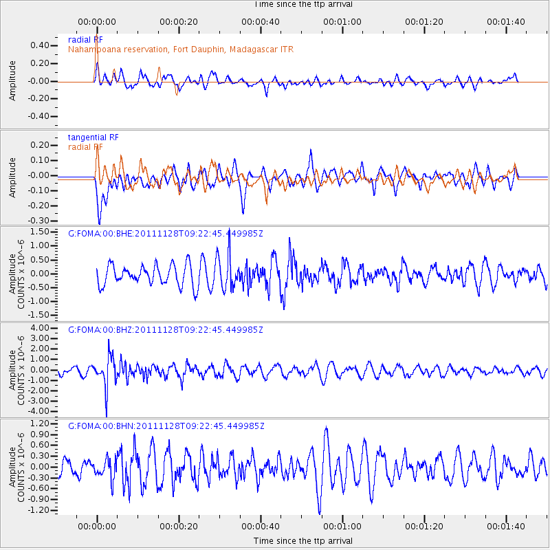
FOMA Nahampoana reservation, Fort Dauphin, Madagascar - Earthquake Result Viewer
*The percent match for this event was below the threshold and hence no stack was calculated.
| Earthquake location: |
Bali Sea |
| Earthquake latitude/longitude: |
-7.0/117.0 |
| Earthquake time(UTC): |
2011/11/28 (332) 09:13:11 GMT |
| Earthquake Depth: |
616 km |
| Earthquake Magnitude: |
5.9 MB, 5.8 MW, 5.8 MW |
| Earthquake Catalog/Contributor: |
WHDF/NEIC |
|
| Network: |
G GEOSCOPE |
| Station: |
FOMA Nahampoana reservation, Fort Dauphin, Madagascar |
| Lat/Lon: |
24.98 S/46.98 E |
| Elevation: |
26 m |
|
| Distance: |
69.0 deg |
| Az: |
246.033 deg |
| Baz: |
88.013 deg |
| Ray Param: |
$rayparam |
*The percent match for this event was below the threshold and hence was not used in the summary stack. |
|
| Radial Match: |
35.94105 % |
| Radial Bump: |
400 |
| Transverse Match: |
61.44731 % |
| Transverse Bump: |
400 |
| SOD ConfigId: |
432046 |
| Insert Time: |
2012-03-06 20:48:03.137 +0000 |
| GWidth: |
2.5 |
| Max Bumps: |
400 |
| Tol: |
0.001 |
|
Signal To Noise
| Channel | StoN | STA | LTA |
| G:FOMA:00:BHZ:20111128T09:22:45.449985Z | 4.587716 | 1.4920182E-6 | 3.2522027E-7 |
| G:FOMA:00:BHN:20111128T09:22:45.449985Z | 1.2086434 | 2.7275973E-7 | 2.2567427E-7 |
| G:FOMA:00:BHE:20111128T09:22:45.449985Z | 1.717592 | 6.2343423E-7 | 3.629699E-7 |
| Arrivals |
| Ps | |
| PpPs | |
| PsPs/PpSs | |


