You are here: Home > Network List > IC - New China Digital Seismograph Network Stations List
> Station ENH Enshi, Hubei Province, China > Earthquake Result Viewer
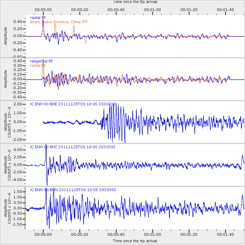
ENH Enshi, Hubei Province, China - Earthquake Result Viewer
*The percent match for this event was below the threshold and hence no stack was calculated.
| Earthquake location: |
Bali Sea |
| Earthquake latitude/longitude: |
-7.0/117.0 |
| Earthquake time(UTC): |
2011/11/28 (332) 09:13:11 GMT |
| Earthquake Depth: |
616 km |
| Earthquake Magnitude: |
5.9 MB, 5.8 MW, 5.8 MW |
| Earthquake Catalog/Contributor: |
WHDF/NEIC |
|
| Network: |
IC New China Digital Seismograph Network |
| Station: |
ENH Enshi, Hubei Province, China |
| Lat/Lon: |
30.28 N/109.49 E |
| Elevation: |
500 m |
|
| Distance: |
37.8 deg |
| Az: |
349.393 deg |
| Baz: |
167.807 deg |
| Ray Param: |
$rayparam |
*The percent match for this event was below the threshold and hence was not used in the summary stack. |
|
| Radial Match: |
71.803085 % |
| Radial Bump: |
400 |
| Transverse Match: |
62.60889 % |
| Transverse Bump: |
400 |
| SOD ConfigId: |
432046 |
| Insert Time: |
2012-03-06 20:48:29.751 +0000 |
| GWidth: |
2.5 |
| Max Bumps: |
400 |
| Tol: |
0.001 |
|
Signal To Noise
| Channel | StoN | STA | LTA |
| IC:ENH:00:BHZ:20111128T09:19:06.393009Z | 18.84066 | 2.0356467E-6 | 1.0804541E-7 |
| IC:ENH:00:BHN:20111128T09:19:06.393009Z | 9.308828 | 7.694018E-7 | 8.265292E-8 |
| IC:ENH:00:BHE:20111128T09:19:06.393009Z | 4.8812203 | 4.2098705E-7 | 8.6246274E-8 |
| Arrivals |
| Ps | |
| PpPs | |
| PsPs/PpSs | |


