You are here: Home > Network List > IW - Intermountain West Stations List
> Station MOOW Moose Ponds, Wyoming, USA > Earthquake Result Viewer
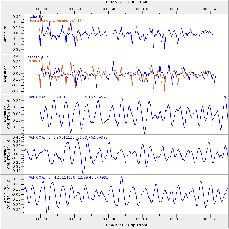
MOOW Moose Ponds, Wyoming, USA - Earthquake Result Viewer
*The percent match for this event was below the threshold and hence no stack was calculated.
| Earthquake location: |
New Ireland Region, P.N.G. |
| Earthquake latitude/longitude: |
-5.5/153.7 |
| Earthquake time(UTC): |
2011/11/28 (332) 12:26:45 GMT |
| Earthquake Depth: |
25 km |
| Earthquake Magnitude: |
5.9 MB, 6.0 MS, 6.1 MW, 6.2 MW |
| Earthquake Catalog/Contributor: |
WHDF/NEIC |
|
| Network: |
IW Intermountain West |
| Station: |
MOOW Moose Ponds, Wyoming, USA |
| Lat/Lon: |
43.75 N/110.74 W |
| Elevation: |
2128 m |
|
| Distance: |
97.7 deg |
| Az: |
46.717 deg |
| Baz: |
269.842 deg |
| Ray Param: |
$rayparam |
*The percent match for this event was below the threshold and hence was not used in the summary stack. |
|
| Radial Match: |
65.26059 % |
| Radial Bump: |
362 |
| Transverse Match: |
50.097694 % |
| Transverse Bump: |
300 |
| SOD ConfigId: |
432046 |
| Insert Time: |
2012-03-06 20:56:29.781 +0000 |
| GWidth: |
2.5 |
| Max Bumps: |
400 |
| Tol: |
0.001 |
|
Signal To Noise
| Channel | StoN | STA | LTA |
| IW:MOOW: :BHZ:20111128T12:39:46.56499Z | 0.56188154 | 8.152081E-8 | 1.4508541E-7 |
| IW:MOOW: :BHN:20111128T12:39:46.56499Z | 2.401779 | 2.181817E-7 | 9.08417E-8 |
| IW:MOOW: :BHE:20111128T12:39:46.56499Z | 0.97623557 | 1.3080428E-7 | 1.3398844E-7 |
| Arrivals |
| Ps | |
| PpPs | |
| PsPs/PpSs | |


