You are here: Home > Network List > UW - Pacific Northwest Regional Seismic Network Stations List
> Station GNW Green Mountain (BB) > Earthquake Result Viewer
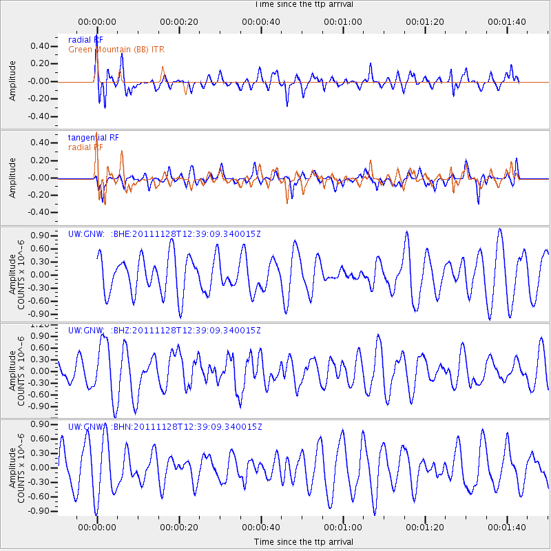
GNW Green Mountain (BB) - Earthquake Result Viewer
*The percent match for this event was below the threshold and hence no stack was calculated.
| Earthquake location: |
New Ireland Region, P.N.G. |
| Earthquake latitude/longitude: |
-5.5/153.7 |
| Earthquake time(UTC): |
2011/11/28 (332) 12:26:45 GMT |
| Earthquake Depth: |
25 km |
| Earthquake Magnitude: |
5.9 MB, 6.0 MS, 6.1 MW, 6.2 MW |
| Earthquake Catalog/Contributor: |
WHDF/NEIC |
|
| Network: |
UW Pacific Northwest Regional Seismic Network |
| Station: |
GNW Green Mountain (BB) |
| Lat/Lon: |
47.56 N/122.83 W |
| Elevation: |
160 m |
|
| Distance: |
89.6 deg |
| Az: |
42.285 deg |
| Baz: |
261.494 deg |
| Ray Param: |
$rayparam |
*The percent match for this event was below the threshold and hence was not used in the summary stack. |
|
| Radial Match: |
63.643795 % |
| Radial Bump: |
400 |
| Transverse Match: |
45.51394 % |
| Transverse Bump: |
400 |
| SOD ConfigId: |
432046 |
| Insert Time: |
2012-03-06 20:59:28.692 +0000 |
| GWidth: |
2.5 |
| Max Bumps: |
400 |
| Tol: |
0.001 |
|
Signal To Noise
| Channel | StoN | STA | LTA |
| UW:GNW: :BHZ:20111128T12:39:09.340015Z | 2.7801082 | 7.548373E-7 | 2.7151364E-7 |
| UW:GNW: :BHN:20111128T12:39:09.340015Z | 1.8325487 | 6.355967E-7 | 3.4683754E-7 |
| UW:GNW: :BHE:20111128T12:39:09.340015Z | 0.7220678 | 3.0386673E-7 | 4.2082854E-7 |
| Arrivals |
| Ps | |
| PpPs | |
| PsPs/PpSs | |


