ATD Arta Cave - Arta, Republic of Djibouti - Earthquake Result Viewer
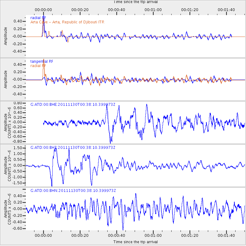
Earthquake location: Philippine Islands Region
Earthquake latitude/longitude: 15.5/119.0
Earthquake time(UTC): 2011/11/30 (334) 00:27:06 GMT
Earthquake Depth: 9.0 km
Earthquake Magnitude: 6.0 MB, 5.5 MS, 6.0 MW, 6.0 MW
Earthquake Catalog/Contributor: WHDF/NEIC
Network: G GEOSCOPE
Station: ATD Arta Cave - Arta, Republic of Djibouti
Lat/Lon: 11.53 N/42.85 E
Elevation: 610 m
Distance: 73.8 deg
Az: 277.744 deg
Baz: 77.142 deg
Ray Param: 0.052756477
Estimated Moho Depth: 22.5 km
Estimated Crust Vp/Vs: 1.86
Assumed Crust Vp: 6.375 km/s
Estimated Crust Vs: 3.427 km/s
Estimated Crust Poisson's Ratio: 0.30
Radial Match: 92.99365 %
Radial Bump: 400
Transverse Match: 81.15606 %
Transverse Bump: 400
SOD ConfigId: 432046
Insert Time: 2012-03-06 21:07:56.686 +0000
GWidth: 2.5
Max Bumps: 400
Tol: 0.001

Signal To Noise

ChannelStoNSTALTA
G:ATD:00:BHZ:20111130T00:38:10.399973Z8.45525555.5386164E-76.550501E-8
G:ATD:00:BHN:20111130T00:38:10.399973Z0.86730886.414409E-87.3957615E-8
G:ATD:00:BHE:20111130T00:38:10.399973Z3.6448322.3012365E-76.313697E-8
Arrivals
Ps3.1 SECOND
PpPs9.8 SECOND
PsPs/PpSs13 SECOND