You are here: Home > Network List > II - Global Seismograph Network (GSN - IRIS/IDA) Stations List
> Station TAU Hobart, Tasmania, Australia > Earthquake Result Viewer
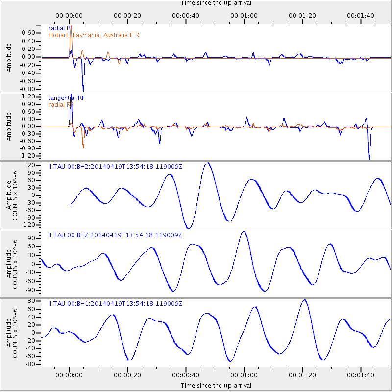
TAU Hobart, Tasmania, Australia - Earthquake Result Viewer
*The percent match for this event was below the threshold and hence no stack was calculated.
| Earthquake location: |
Solomon Islands |
| Earthquake latitude/longitude: |
-7.1/154.7 |
| Earthquake time(UTC): |
2014/04/19 (109) 13:47:51 GMT |
| Earthquake Depth: |
72 km |
| Earthquake Magnitude: |
5.6 MB |
| Earthquake Catalog/Contributor: |
NEIC PDE/NEIC COMCAT |
|
| Network: |
II Global Seismograph Network (GSN - IRIS/IDA) |
| Station: |
TAU Hobart, Tasmania, Australia |
| Lat/Lon: |
42.91 S/147.32 E |
| Elevation: |
132 m |
|
| Distance: |
36.3 deg |
| Az: |
189.216 deg |
| Baz: |
12.494 deg |
| Ray Param: |
$rayparam |
*The percent match for this event was below the threshold and hence was not used in the summary stack. |
|
| Radial Match: |
88.25886 % |
| Radial Bump: |
400 |
| Transverse Match: |
62.136055 % |
| Transverse Bump: |
400 |
| SOD ConfigId: |
3390531 |
| Insert Time: |
2019-04-11 12:08:09.282 +0000 |
| GWidth: |
2.5 |
| Max Bumps: |
400 |
| Tol: |
0.001 |
|
Signal To Noise
| Channel | StoN | STA | LTA |
| II:TAU:00:BHZ:20140419T13:54:18.119009Z | 1.1494316 | 1.3827571E-5 | 1.202992E-5 |
| II:TAU:00:BH1:20140419T13:54:18.119009Z | 0.4160559 | 8.891714E-6 | 2.1371441E-5 |
| II:TAU:00:BH2:20140419T13:54:18.119009Z | 2.2396593 | 4.819716E-5 | 2.1519862E-5 |
| Arrivals |
| Ps | |
| PpPs | |
| PsPs/PpSs | |


