You are here: Home > Network List > IC - New China Digital Seismograph Network Stations List
> Station ENH Enshi, Hubei Province, China > Earthquake Result Viewer
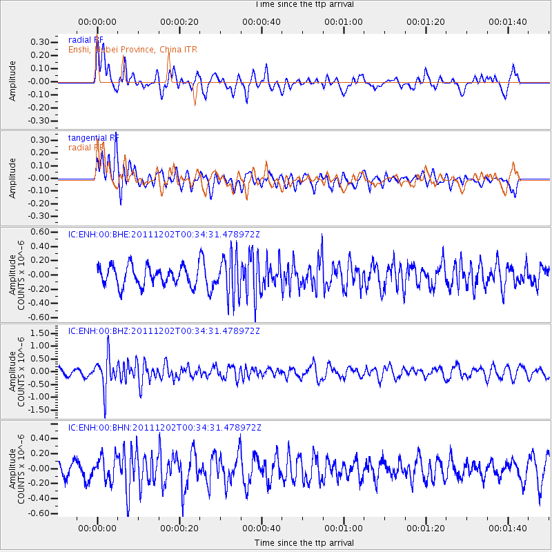
ENH Enshi, Hubei Province, China - Earthquake Result Viewer
*The percent match for this event was below the threshold and hence no stack was calculated.
| Earthquake location: |
South Indian Ocean |
| Earthquake latitude/longitude: |
-34.0/58.1 |
| Earthquake time(UTC): |
2011/12/02 (336) 00:22:51 GMT |
| Earthquake Depth: |
10 km |
| Earthquake Magnitude: |
5.7 MB, 5.1 MS, 5.6 MW, 5.4 MW |
| Earthquake Catalog/Contributor: |
WHDF/NEIC |
|
| Network: |
IC New China Digital Seismograph Network |
| Station: |
ENH Enshi, Hubei Province, China |
| Lat/Lon: |
30.28 N/109.49 E |
| Elevation: |
500 m |
|
| Distance: |
80.3 deg |
| Az: |
43.321 deg |
| Baz: |
221.213 deg |
| Ray Param: |
$rayparam |
*The percent match for this event was below the threshold and hence was not used in the summary stack. |
|
| Radial Match: |
52.74573 % |
| Radial Bump: |
400 |
| Transverse Match: |
66.77203 % |
| Transverse Bump: |
400 |
| SOD ConfigId: |
432046 |
| Insert Time: |
2012-03-06 21:26:00.798 +0000 |
| GWidth: |
2.5 |
| Max Bumps: |
400 |
| Tol: |
0.001 |
|
Signal To Noise
| Channel | StoN | STA | LTA |
| IC:ENH:00:BHZ:20111202T00:34:31.478972Z | 2.7327063 | 6.320849E-7 | 2.3130363E-7 |
| IC:ENH:00:BHN:20111202T00:34:31.478972Z | 1.0760458 | 1.5737812E-7 | 1.4625599E-7 |
| IC:ENH:00:BHE:20111202T00:34:31.478972Z | 2.2002444 | 2.922672E-7 | 1.3283396E-7 |
| Arrivals |
| Ps | |
| PpPs | |
| PsPs/PpSs | |


