You are here: Home > Network List > TA - USArray Transportable Network (new EarthScope stations) Stations List
> Station A04D Lummi Island, WA, USA > Earthquake Result Viewer
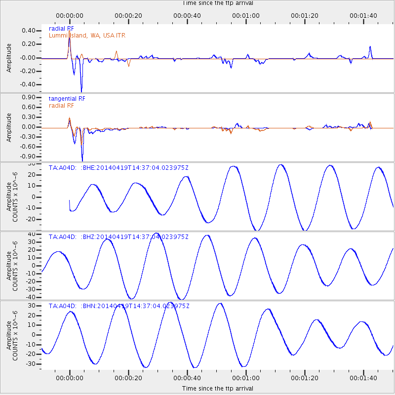
A04D Lummi Island, WA, USA - Earthquake Result Viewer
*The percent match for this event was below the threshold and hence no stack was calculated.
| Earthquake location: |
Solomon Islands |
| Earthquake latitude/longitude: |
-7.1/154.9 |
| Earthquake time(UTC): |
2014/04/19 (109) 14:24:38 GMT |
| Earthquake Depth: |
41 km |
| Earthquake Magnitude: |
4.8 mb |
| Earthquake Catalog/Contributor: |
ISC/ISC |
|
| Network: |
TA USArray Transportable Network (new EarthScope stations) |
| Station: |
A04D Lummi Island, WA, USA |
| Lat/Lon: |
48.72 N/122.71 W |
| Elevation: |
13 m |
|
| Distance: |
90.2 deg |
| Az: |
41.023 deg |
| Baz: |
259.635 deg |
| Ray Param: |
$rayparam |
*The percent match for this event was below the threshold and hence was not used in the summary stack. |
|
| Radial Match: |
94.52075 % |
| Radial Bump: |
400 |
| Transverse Match: |
96.358025 % |
| Transverse Bump: |
400 |
| SOD ConfigId: |
3390531 |
| Insert Time: |
2019-04-11 12:12:56.185 +0000 |
| GWidth: |
2.5 |
| Max Bumps: |
400 |
| Tol: |
0.001 |
|
Signal To Noise
| Channel | StoN | STA | LTA |
| TA:A04D: :BHZ:20140419T14:37:04.023975Z | 2.3640828 | 1.84969E-5 | 7.824134E-6 |
| TA:A04D: :BHN:20140419T14:37:04.023975Z | 1.87361 | 1.9779502E-5 | 1.0556893E-5 |
| TA:A04D: :BHE:20140419T14:37:04.023975Z | 1.3757411 | 1.2837708E-5 | 9.331486E-6 |
| Arrivals |
| Ps | |
| PpPs | |
| PsPs/PpSs | |


