HYB Hyderabad, India - Earthquake Result Viewer
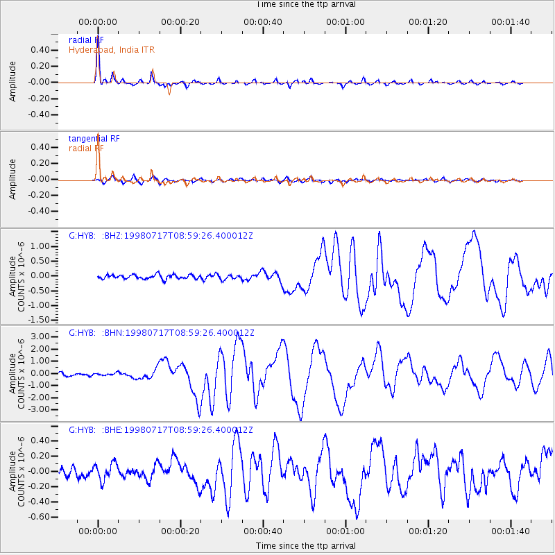
Earthquake location: Near N Coast Of New Guinea, P.N.G.
Earthquake latitude/longitude: -3.0/141.9
Earthquake time(UTC): 1998/07/17 (198) 08:49:13 GMT
Earthquake Depth: 10 km
Earthquake Magnitude: 5.8 MB, 7.1 MS, 7.1 UNKNOWN, 6.4 ME
Earthquake Catalog/Contributor: WHDF/NEIC
Network: G GEOSCOPE
Station: HYB Hyderabad, India
Lat/Lon: 17.42 N/78.55 E
Elevation: 510 m
Distance: 65.7 deg
Az: 290.498 deg
Baz: 101.531 deg
Ray Param: 0.058122307
Estimated Moho Depth: 33.0 km
Estimated Crust Vp/Vs: 1.66
Assumed Crust Vp: 6.459 km/s
Estimated Crust Vs: 3.885 km/s
Estimated Crust Poisson's Ratio: 0.22
Radial Match: 97.71667 %
Radial Bump: 290
Transverse Match: 82.83908 %
Transverse Bump: 400
SOD ConfigId: 4480
Insert Time: 2010-02-26 22:55:34.926 +0000
GWidth: 2.5
Max Bumps: 400
Tol: 0.001

Signal To Noise

ChannelStoNSTALTA
G:HYB: :BHN:19980717T08:59:26.400012Z0.746684131.0602386E-71.4199293E-7
G:HYB: :BHE:19980717T08:59:26.400012Z1.51622221.1289502E-77.445809E-8
G:HYB: :BHZ:19980717T08:59:26.400012Z1.16850648.1333354E-86.960454E-8
Arrivals
Ps3.5 SECOND
PpPs13 SECOND
PsPs/PpSs17 SECOND