HYB Hyderabad, India - Earthquake Result Viewer
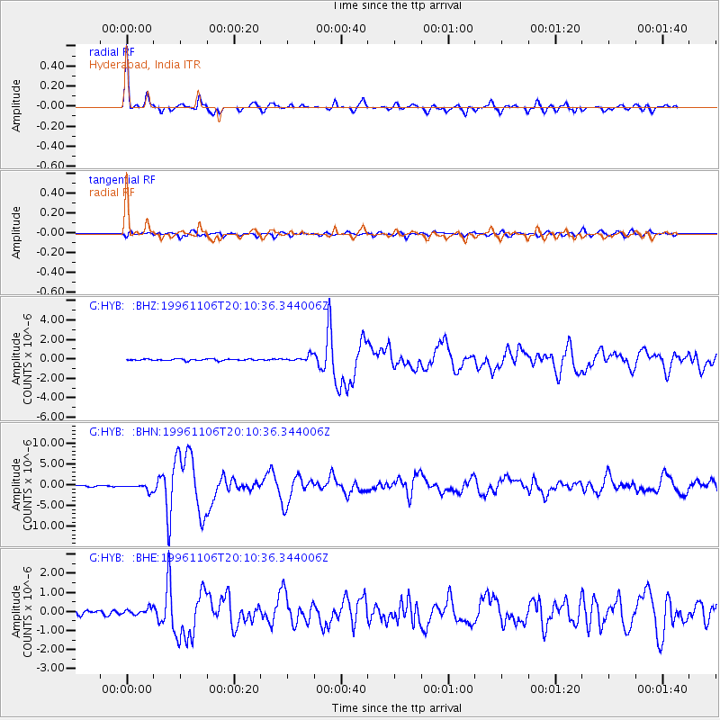
Earthquake location: Bonin Islands, Japan Region
Earthquake latitude/longitude: 28.0/143.5
Earthquake time(UTC): 1996/11/06 (311) 20:00:58 GMT
Earthquake Depth: 9.0 km
Earthquake Magnitude: 6.4 MB, 6.5 MS, 6.6 UNKNOWN, 6.4 ME
Earthquake Catalog/Contributor: WHDF/NEIC
Network: G GEOSCOPE
Station: HYB Hyderabad, India
Lat/Lon: 17.42 N/78.55 E
Elevation: 510 m
Distance: 60.3 deg
Az: 274.924 deg
Baz: 67.335 deg
Ray Param: 0.061645903
Estimated Moho Depth: 34.5 km
Estimated Crust Vp/Vs: 1.68
Assumed Crust Vp: 6.459 km/s
Estimated Crust Vs: 3.839 km/s
Estimated Crust Poisson's Ratio: 0.23
Radial Match: 94.93761 %
Radial Bump: 283
Transverse Match: 75.42768 %
Transverse Bump: 400
SOD ConfigId: 4480
Insert Time: 2010-02-26 22:55:37.306 +0000
GWidth: 2.5
Max Bumps: 400
Tol: 0.001

Signal To Noise

ChannelStoNSTALTA
G:HYB: :BHN:19961106T20:10:36.344006Z6.5396267.856E-71.2012919E-7
G:HYB: :BHE:19961106T20:10:36.344006Z1.65072211.7074633E-71.0343736E-7
G:HYB: :BHZ:19961106T20:10:36.344006Z4.06725033.1789784E-77.816038E-8
Arrivals
Ps3.8 SECOND
PpPs14 SECOND
PsPs/PpSs17 SECOND