You are here: Home > Network List > US - United States National Seismic Network Stations List
> Station MSO Missoula, Montana, USA > Earthquake Result Viewer
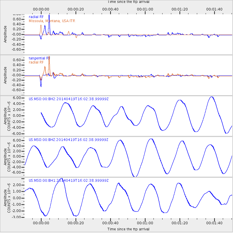
MSO Missoula, Montana, USA - Earthquake Result Viewer
*The percent match for this event was below the threshold and hence no stack was calculated.
| Earthquake location: |
Solomon Islands |
| Earthquake latitude/longitude: |
-6.6/154.8 |
| Earthquake time(UTC): |
2014/04/19 (109) 15:49:51 GMT |
| Earthquake Depth: |
56 km |
| Earthquake Magnitude: |
4.8 mb |
| Earthquake Catalog/Contributor: |
ISC/ISC |
|
| Network: |
US United States National Seismic Network |
| Station: |
MSO Missoula, Montana, USA |
| Lat/Lon: |
46.83 N/113.94 W |
| Elevation: |
1264 m |
|
| Distance: |
95.6 deg |
| Az: |
43.608 deg |
| Baz: |
266.409 deg |
| Ray Param: |
$rayparam |
*The percent match for this event was below the threshold and hence was not used in the summary stack. |
|
| Radial Match: |
93.77477 % |
| Radial Bump: |
400 |
| Transverse Match: |
78.67115 % |
| Transverse Bump: |
250 |
| SOD ConfigId: |
3390531 |
| Insert Time: |
2019-04-11 12:17:19.939 +0000 |
| GWidth: |
2.5 |
| Max Bumps: |
400 |
| Tol: |
0.001 |
|
Signal To Noise
| Channel | StoN | STA | LTA |
| US:MSO:00:BHZ:20140419T16:02:38.99999Z | 0.7087813 | 2.5001755E-6 | 3.5274286E-6 |
| US:MSO:00:BH1:20140419T16:02:38.99999Z | 2.3606567 | 2.3898838E-6 | 1.0123808E-6 |
| US:MSO:00:BH2:20140419T16:02:38.99999Z | 1.0454335 | 2.9559571E-6 | 2.8274944E-6 |
| Arrivals |
| Ps | |
| PpPs | |
| PsPs/PpSs | |


