You are here: Home > Network List > TA - USArray Transportable Network (new EarthScope stations) Stations List
> Station T40A Mansfield, MO, USA > Earthquake Result Viewer
T40A Mansfield, MO, USA - Earthquake Result Viewer
*The percent match for this event was below the threshold and hence no stack was calculated.
| Earthquake location: |
Near Coast Of Northern Chile |
| Earthquake latitude/longitude: |
-27.9/-70.9 |
| Earthquake time(UTC): |
2011/12/07 (341) 22:23:09 GMT |
| Earthquake Depth: |
20 km |
| Earthquake Magnitude: |
5.8 MB, 5.8 MS, 6.1 MW, 6.0 MW |
| Earthquake Catalog/Contributor: |
WHDF/NEIC |
|
| Network: |
TA USArray Transportable Network (new EarthScope stations) |
| Station: |
T40A Mansfield, MO, USA |
| Lat/Lon: |
37.15 N/92.52 W |
| Elevation: |
399 m |
|
| Distance: |
67.8 deg |
| Az: |
341.478 deg |
| Baz: |
159.397 deg |
| Ray Param: |
$rayparam |
*The percent match for this event was below the threshold and hence was not used in the summary stack. |
|
| Radial Match: |
78.53922 % |
| Radial Bump: |
400 |
| Transverse Match: |
63.24251 % |
| Transverse Bump: |
400 |
| SOD ConfigId: |
432046 |
| Insert Time: |
2012-03-08 00:41:44.926 +0000 |
| GWidth: |
2.5 |
| Max Bumps: |
400 |
| Tol: |
0.001 |
|
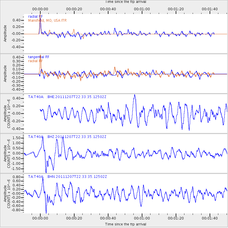
Signal To Noise
| Channel | StoN | STA | LTA |
| TA:T40A: :BHZ:20111207T22:33:35.12502Z | 6.6368036 | 9.513072E-7 | 1.4333816E-7 |
| TA:T40A: :BHN:20111207T22:33:35.12502Z | 4.5572267 | 4.0885757E-7 | 8.9716316E-8 |
| TA:T40A: :BHE:20111207T22:33:35.12502Z | 1.2261474 | 1.2907716E-7 | 1.05270516E-7 |
| Arrivals |
| Ps | |
| PpPs | |
| PsPs/PpSs | |


