You are here: Home > Network List > TA - USArray Transportable Network (new EarthScope stations) Stations List
> Station L39A Vinton, IA, USA > Earthquake Result Viewer
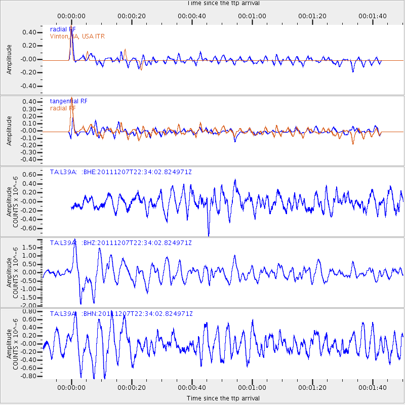
L39A Vinton, IA, USA - Earthquake Result Viewer
*The percent match for this event was below the threshold and hence no stack was calculated.
| Earthquake location: |
Near Coast Of Northern Chile |
| Earthquake latitude/longitude: |
-27.9/-70.9 |
| Earthquake time(UTC): |
2011/12/07 (341) 22:23:09 GMT |
| Earthquake Depth: |
20 km |
| Earthquake Magnitude: |
5.8 MB, 5.8 MS, 6.1 MW, 6.0 MW |
| Earthquake Catalog/Contributor: |
WHDF/NEIC |
|
| Network: |
TA USArray Transportable Network (new EarthScope stations) |
| Station: |
L39A Vinton, IA, USA |
| Lat/Lon: |
42.12 N/92.00 W |
| Elevation: |
261 m |
|
| Distance: |
72.3 deg |
| Az: |
343.69 deg |
| Baz: |
160.481 deg |
| Ray Param: |
$rayparam |
*The percent match for this event was below the threshold and hence was not used in the summary stack. |
|
| Radial Match: |
74.01123 % |
| Radial Bump: |
400 |
| Transverse Match: |
62.098015 % |
| Transverse Bump: |
400 |
| SOD ConfigId: |
432046 |
| Insert Time: |
2012-03-08 00:43:21.154 +0000 |
| GWidth: |
2.5 |
| Max Bumps: |
400 |
| Tol: |
0.001 |
|
Signal To Noise
| Channel | StoN | STA | LTA |
| TA:L39A: :BHZ:20111207T22:34:02.824971Z | 5.7760816 | 1.0378837E-6 | 1.796865E-7 |
| TA:L39A: :BHN:20111207T22:34:02.824971Z | 4.1472087 | 4.333747E-7 | 1.0449792E-7 |
| TA:L39A: :BHE:20111207T22:34:02.824971Z | 2.0461066 | 2.3588206E-7 | 1.1528337E-7 |
| Arrivals |
| Ps | |
| PpPs | |
| PsPs/PpSs | |


