You are here: Home > Network List > TA - USArray Transportable Network (new EarthScope stations) Stations List
> Station M42A Sheffield, IL, USA > Earthquake Result Viewer
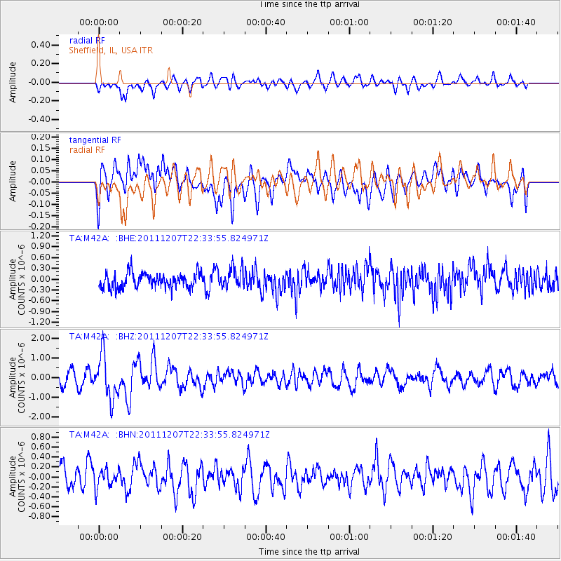
M42A Sheffield, IL, USA - Earthquake Result Viewer
*The percent match for this event was below the threshold and hence no stack was calculated.
| Earthquake location: |
Near Coast Of Northern Chile |
| Earthquake latitude/longitude: |
-27.9/-70.9 |
| Earthquake time(UTC): |
2011/12/07 (341) 22:23:09 GMT |
| Earthquake Depth: |
20 km |
| Earthquake Magnitude: |
5.8 MB, 5.8 MS, 6.1 MW, 6.0 MW |
| Earthquake Catalog/Contributor: |
WHDF/NEIC |
|
| Network: |
TA USArray Transportable Network (new EarthScope stations) |
| Station: |
M42A Sheffield, IL, USA |
| Lat/Lon: |
41.45 N/89.76 W |
| Elevation: |
212 m |
|
| Distance: |
71.2 deg |
| Az: |
345.14 deg |
| Baz: |
162.424 deg |
| Ray Param: |
$rayparam |
*The percent match for this event was below the threshold and hence was not used in the summary stack. |
|
| Radial Match: |
61.397644 % |
| Radial Bump: |
400 |
| Transverse Match: |
48.486774 % |
| Transverse Bump: |
400 |
| SOD ConfigId: |
432046 |
| Insert Time: |
2012-03-08 00:43:59.317 +0000 |
| GWidth: |
2.5 |
| Max Bumps: |
400 |
| Tol: |
0.001 |
|
Signal To Noise
| Channel | StoN | STA | LTA |
| TA:M42A: :BHZ:20111207T22:33:55.824971Z | 4.195607 | 1.1310368E-6 | 2.6957645E-7 |
| TA:M42A: :BHN:20111207T22:33:55.824971Z | 1.0533494 | 1.8221264E-7 | 1.7298404E-7 |
| TA:M42A: :BHE:20111207T22:33:55.824971Z | 1.385219 | 2.808749E-7 | 2.027657E-7 |
| Arrivals |
| Ps | |
| PpPs | |
| PsPs/PpSs | |


