You are here: Home > Network List > TA - USArray Transportable Network (new EarthScope stations) Stations List
> Station G43A Wallace, MI, USA > Earthquake Result Viewer
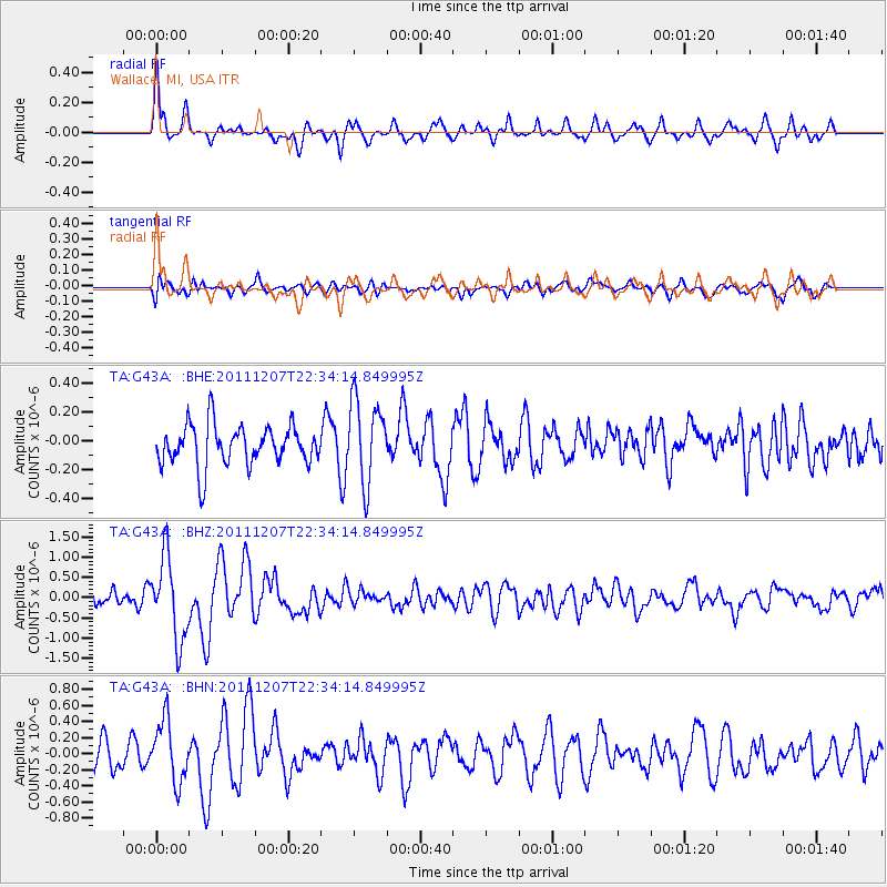
G43A Wallace, MI, USA - Earthquake Result Viewer
*The percent match for this event was below the threshold and hence no stack was calculated.
| Earthquake location: |
Near Coast Of Northern Chile |
| Earthquake latitude/longitude: |
-27.9/-70.9 |
| Earthquake time(UTC): |
2011/12/07 (341) 22:23:09 GMT |
| Earthquake Depth: |
20 km |
| Earthquake Magnitude: |
5.8 MB, 5.8 MS, 6.1 MW, 6.0 MW |
| Earthquake Catalog/Contributor: |
WHDF/NEIC |
|
| Network: |
TA USArray Transportable Network (new EarthScope stations) |
| Station: |
G43A Wallace, MI, USA |
| Lat/Lon: |
45.26 N/87.69 W |
| Elevation: |
213 m |
|
| Distance: |
74.4 deg |
| Az: |
347.786 deg |
| Baz: |
164.626 deg |
| Ray Param: |
$rayparam |
*The percent match for this event was below the threshold and hence was not used in the summary stack. |
|
| Radial Match: |
72.01439 % |
| Radial Bump: |
400 |
| Transverse Match: |
43.573975 % |
| Transverse Bump: |
400 |
| SOD ConfigId: |
432046 |
| Insert Time: |
2012-03-08 00:45:46.744 +0000 |
| GWidth: |
2.5 |
| Max Bumps: |
400 |
| Tol: |
0.001 |
|
Signal To Noise
| Channel | StoN | STA | LTA |
| TA:G43A: :BHZ:20111207T22:34:14.849995Z | 4.6209407 | 1.0212228E-6 | 2.209989E-7 |
| TA:G43A: :BHN:20111207T22:34:14.849995Z | 2.1206987 | 3.8236794E-7 | 1.8030282E-7 |
| TA:G43A: :BHE:20111207T22:34:14.849995Z | 2.049942 | 2.893213E-7 | 1.4113634E-7 |
| Arrivals |
| Ps | |
| PpPs | |
| PsPs/PpSs | |


