You are here: Home > Network List > UW - Pacific Northwest Regional Seismic Network Stations List
> Station LEBA Lebam, WA, USA > Earthquake Result Viewer
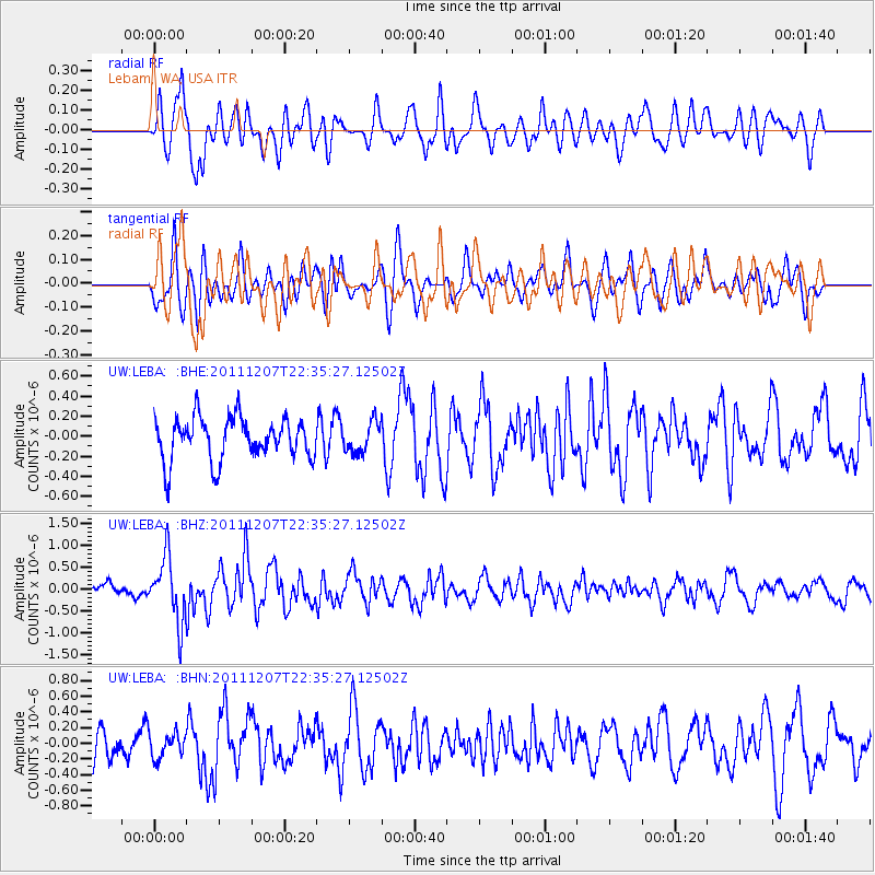
LEBA Lebam, WA, USA - Earthquake Result Viewer
*The percent match for this event was below the threshold and hence no stack was calculated.
| Earthquake location: |
Near Coast Of Northern Chile |
| Earthquake latitude/longitude: |
-27.9/-70.9 |
| Earthquake time(UTC): |
2011/12/07 (341) 22:23:09 GMT |
| Earthquake Depth: |
20 km |
| Earthquake Magnitude: |
5.8 MB, 5.8 MS, 6.1 MW, 6.0 MW |
| Earthquake Catalog/Contributor: |
WHDF/NEIC |
|
| Network: |
UW Pacific Northwest Regional Seismic Network |
| Station: |
LEBA Lebam, WA, USA |
| Lat/Lon: |
46.55 N/123.56 W |
| Elevation: |
73 m |
|
| Distance: |
88.1 deg |
| Az: |
326.705 deg |
| Baz: |
135.256 deg |
| Ray Param: |
$rayparam |
*The percent match for this event was below the threshold and hence was not used in the summary stack. |
|
| Radial Match: |
68.589966 % |
| Radial Bump: |
400 |
| Transverse Match: |
54.46787 % |
| Transverse Bump: |
400 |
| SOD ConfigId: |
432046 |
| Insert Time: |
2012-03-08 00:49:51.361 +0000 |
| GWidth: |
2.5 |
| Max Bumps: |
400 |
| Tol: |
0.001 |
|
Signal To Noise
| Channel | StoN | STA | LTA |
| UW:LEBA: :BHZ:20111207T22:35:27.12502Z | 4.8941073 | 7.376748E-7 | 1.5072715E-7 |
| UW:LEBA: :BHN:20111207T22:35:27.12502Z | 0.8500324 | 1.5807849E-7 | 1.8596761E-7 |
| UW:LEBA: :BHE:20111207T22:35:27.12502Z | 0.71805835 | 1.526119E-7 | 2.1253413E-7 |
| Arrivals |
| Ps | |
| PpPs | |
| PsPs/PpSs | |


