You are here: Home > Network List > TA - USArray Transportable Network (new EarthScope stations) Stations List
> Station O03E Paynes Creek, CA, USA > Earthquake Result Viewer
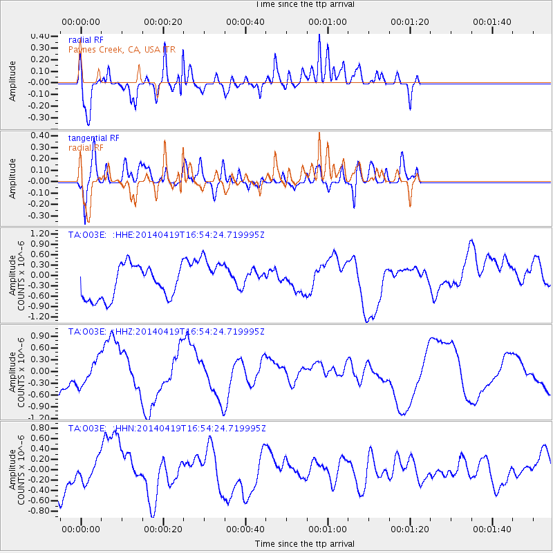
O03E Paynes Creek, CA, USA - Earthquake Result Viewer
*The percent match for this event was below the threshold and hence no stack was calculated.
| Earthquake location: |
Solomon Islands |
| Earthquake latitude/longitude: |
-6.6/154.7 |
| Earthquake time(UTC): |
2014/04/19 (109) 16:42:04 GMT |
| Earthquake Depth: |
48 km |
| Earthquake Magnitude: |
4.9 mb |
| Earthquake Catalog/Contributor: |
ISC/ISC |
|
| Network: |
TA USArray Transportable Network (new EarthScope stations) |
| Station: |
O03E Paynes Creek, CA, USA |
| Lat/Lon: |
40.29 N/121.80 W |
| Elevation: |
967 m |
|
| Distance: |
89.3 deg |
| Az: |
49.466 deg |
| Baz: |
260.806 deg |
| Ray Param: |
$rayparam |
*The percent match for this event was below the threshold and hence was not used in the summary stack. |
|
| Radial Match: |
72.55681 % |
| Radial Bump: |
400 |
| Transverse Match: |
57.70059 % |
| Transverse Bump: |
400 |
| SOD ConfigId: |
3390531 |
| Insert Time: |
2019-04-11 12:20:55.805 +0000 |
| GWidth: |
2.5 |
| Max Bumps: |
400 |
| Tol: |
0.001 |
|
Signal To Noise
| Channel | StoN | STA | LTA |
| TA:O03E: :HHZ:20140419T16:54:24.719995Z | 1.1445141 | 3.2009035E-7 | 2.7967357E-7 |
| TA:O03E: :HHN:20140419T16:54:24.719995Z | 0.610495 | 2.0454674E-7 | 3.3505066E-7 |
| TA:O03E: :HHE:20140419T16:54:24.719995Z | 1.3511214 | 6.2559815E-7 | 4.630214E-7 |
| Arrivals |
| Ps | |
| PpPs | |
| PsPs/PpSs | |


