You are here: Home > Network List > BK - Berkeley Digital Seismograph Network Stations List
> Station HUMO Hull Mountain, OR > Earthquake Result Viewer
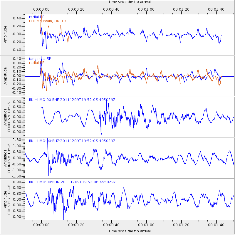
HUMO Hull Mountain, OR - Earthquake Result Viewer
*The percent match for this event was below the threshold and hence no stack was calculated.
| Earthquake location: |
Sea Of Okhotsk |
| Earthquake latitude/longitude: |
47.0/144.6 |
| Earthquake time(UTC): |
2011/12/09 (343) 19:42:57 GMT |
| Earthquake Depth: |
392 km |
| Earthquake Magnitude: |
5.7 MB, 5.7 MW, 5.8 MW |
| Earthquake Catalog/Contributor: |
WHDF/NEIC |
|
| Network: |
BK Berkeley Digital Seismograph Network |
| Station: |
HUMO Hull Mountain, OR |
| Lat/Lon: |
42.61 N/122.96 W |
| Elevation: |
555 m |
|
| Distance: |
62.0 deg |
| Az: |
56.673 deg |
| Baz: |
309.24 deg |
| Ray Param: |
$rayparam |
*The percent match for this event was below the threshold and hence was not used in the summary stack. |
|
| Radial Match: |
64.71618 % |
| Radial Bump: |
400 |
| Transverse Match: |
62.30194 % |
| Transverse Bump: |
400 |
| SOD ConfigId: |
432046 |
| Insert Time: |
2012-03-08 01:02:08.442 +0000 |
| GWidth: |
2.5 |
| Max Bumps: |
400 |
| Tol: |
0.001 |
|
Signal To Noise
| Channel | StoN | STA | LTA |
| BK:HUMO:00:BHZ:20111209T19:52:06.495029Z | 1.9033087 | 5.762417E-7 | 3.0275788E-7 |
| BK:HUMO:00:BHN:20111209T19:52:06.495029Z | 0.8267904 | 1.645812E-7 | 1.9906035E-7 |
| BK:HUMO:00:BHE:20111209T19:52:06.495029Z | 1.3242992 | 3.6158133E-7 | 2.7303597E-7 |
| Arrivals |
| Ps | |
| PpPs | |
| PsPs/PpSs | |


