You are here: Home > Network List > CI - Caltech Regional Seismic Network Stations List
> Station MPM Manuel Prospect Mine, California, USA > Earthquake Result Viewer
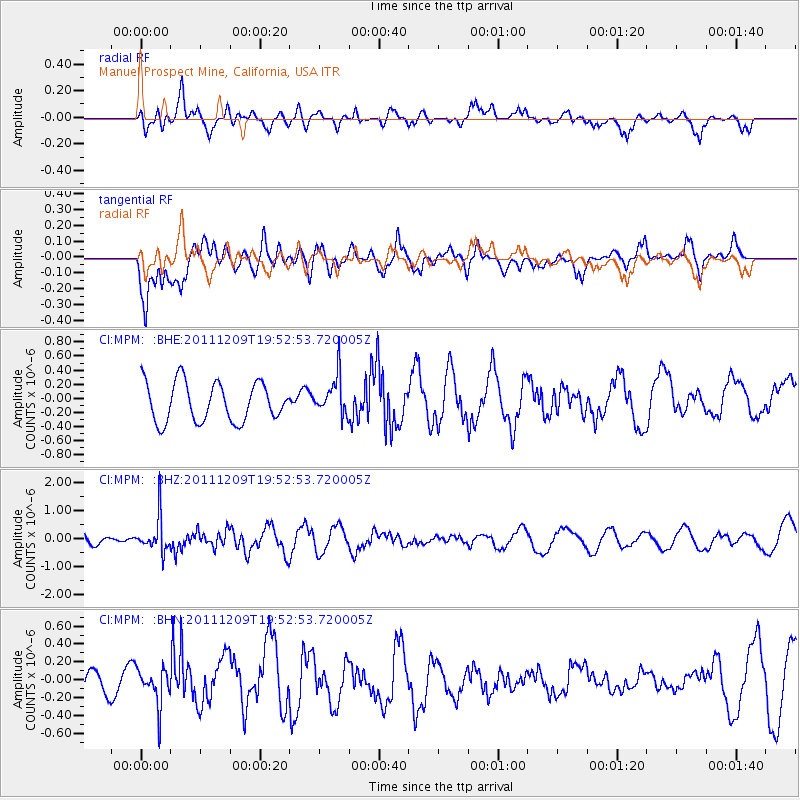
MPM Manuel Prospect Mine, California, USA - Earthquake Result Viewer
*The percent match for this event was below the threshold and hence no stack was calculated.
| Earthquake location: |
Sea Of Okhotsk |
| Earthquake latitude/longitude: |
47.0/144.6 |
| Earthquake time(UTC): |
2011/12/09 (343) 19:42:57 GMT |
| Earthquake Depth: |
392 km |
| Earthquake Magnitude: |
5.7 MB, 5.7 MW, 5.8 MW |
| Earthquake Catalog/Contributor: |
WHDF/NEIC |
|
| Network: |
CI Caltech Regional Seismic Network |
| Station: |
MPM Manuel Prospect Mine, California, USA |
| Lat/Lon: |
36.06 N/117.49 W |
| Elevation: |
185 m |
|
| Distance: |
69.5 deg |
| Az: |
58.965 deg |
| Baz: |
313.643 deg |
| Ray Param: |
$rayparam |
*The percent match for this event was below the threshold and hence was not used in the summary stack. |
|
| Radial Match: |
56.463364 % |
| Radial Bump: |
400 |
| Transverse Match: |
56.824165 % |
| Transverse Bump: |
400 |
| SOD ConfigId: |
432046 |
| Insert Time: |
2012-03-08 01:03:36.821 +0000 |
| GWidth: |
2.5 |
| Max Bumps: |
400 |
| Tol: |
0.001 |
|
Signal To Noise
| Channel | StoN | STA | LTA |
| CI:MPM: :BHZ:20111209T19:52:53.720005Z | 3.4156027 | 6.28683E-7 | 1.840621E-7 |
| CI:MPM: :BHN:20111209T19:52:53.720005Z | 0.84487474 | 2.0544478E-7 | 2.4316597E-7 |
| CI:MPM: :BHE:20111209T19:52:53.720005Z | 0.99733543 | 2.7470148E-7 | 2.7543538E-7 |
| Arrivals |
| Ps | |
| PpPs | |
| PsPs/PpSs | |


