You are here: Home > Network List > AV - Alaska Volcano Observatory Stations List
> Station SPCR Ckakachatna River, Mount Spurr, Alaska > Earthquake Result Viewer
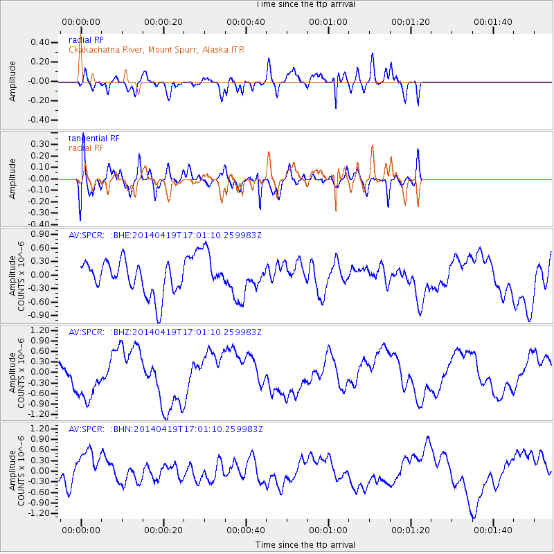
SPCR Ckakachatna River, Mount Spurr, Alaska - Earthquake Result Viewer
*The percent match for this event was below the threshold and hence no stack was calculated.
| Earthquake location: |
Solomon Islands |
| Earthquake latitude/longitude: |
-7.1/154.9 |
| Earthquake time(UTC): |
2014/04/19 (109) 16:49:39 GMT |
| Earthquake Depth: |
41 km |
| Earthquake Magnitude: |
5.2 mb |
| Earthquake Catalog/Contributor: |
ISC/ISC |
|
| Network: |
AV Alaska Volcano Observatory |
| Station: |
SPCR Ckakachatna River, Mount Spurr, Alaska |
| Lat/Lon: |
61.20 N/152.21 W |
| Elevation: |
984 m |
|
| Distance: |
79.5 deg |
| Az: |
23.136 deg |
| Baz: |
233.641 deg |
| Ray Param: |
$rayparam |
*The percent match for this event was below the threshold and hence was not used in the summary stack. |
|
| Radial Match: |
77.34407 % |
| Radial Bump: |
400 |
| Transverse Match: |
56.56248 % |
| Transverse Bump: |
400 |
| SOD ConfigId: |
3390531 |
| Insert Time: |
2019-04-11 12:22:54.514 +0000 |
| GWidth: |
2.5 |
| Max Bumps: |
400 |
| Tol: |
0.001 |
|
Signal To Noise
| Channel | StoN | STA | LTA |
| AV:SPCR: :BHZ:20140419T17:01:10.259983Z | 3.058652 | 6.4621776E-7 | 2.1127534E-7 |
| AV:SPCR: :BHN:20140419T17:01:10.259983Z | 3.1516669 | 5.5209375E-7 | 1.7517517E-7 |
| AV:SPCR: :BHE:20140419T17:01:10.259983Z | 1.310715 | 4.742488E-7 | 3.618245E-7 |
| Arrivals |
| Ps | |
| PpPs | |
| PsPs/PpSs | |


