You are here: Home > Network List > TA - USArray Transportable Network (new EarthScope stations) Stations List
> Station N35A Tabor, IA, USA > Earthquake Result Viewer
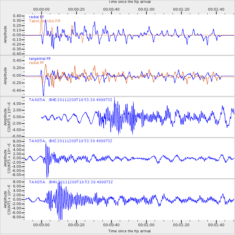
N35A Tabor, IA, USA - Earthquake Result Viewer
*The percent match for this event was below the threshold and hence no stack was calculated.
| Earthquake location: |
Sea Of Okhotsk |
| Earthquake latitude/longitude: |
47.0/144.6 |
| Earthquake time(UTC): |
2011/12/09 (343) 19:42:57 GMT |
| Earthquake Depth: |
392 km |
| Earthquake Magnitude: |
5.7 MB, 5.7 MW, 5.8 MW |
| Earthquake Catalog/Contributor: |
WHDF/NEIC |
|
| Network: |
TA USArray Transportable Network (new EarthScope stations) |
| Station: |
N35A Tabor, IA, USA |
| Lat/Lon: |
40.86 N/95.64 W |
| Elevation: |
353 m |
|
| Distance: |
77.5 deg |
| Az: |
42.394 deg |
| Baz: |
322.532 deg |
| Ray Param: |
$rayparam |
*The percent match for this event was below the threshold and hence was not used in the summary stack. |
|
| Radial Match: |
59.338985 % |
| Radial Bump: |
400 |
| Transverse Match: |
67.11503 % |
| Transverse Bump: |
400 |
| SOD ConfigId: |
432046 |
| Insert Time: |
2012-03-08 01:14:56.870 +0000 |
| GWidth: |
2.5 |
| Max Bumps: |
400 |
| Tol: |
0.001 |
|
Signal To Noise
| Channel | StoN | STA | LTA |
| TA:N35A: :BHZ:20111209T19:53:39.499973Z | 3.1949615 | 3.3063702E-6 | 1.0348701E-6 |
| TA:N35A: :BHN:20111209T19:53:39.499973Z | 2.4952338 | 1.4947021E-6 | 5.990229E-7 |
| TA:N35A: :BHE:20111209T19:53:39.499973Z | 1.9383881 | 1.3413231E-6 | 6.919786E-7 |
| Arrivals |
| Ps | |
| PpPs | |
| PsPs/PpSs | |


