You are here: Home > Network List > G - GEOSCOPE Stations List
> Station TAOE Taiohae, Marquises islands > Earthquake Result Viewer
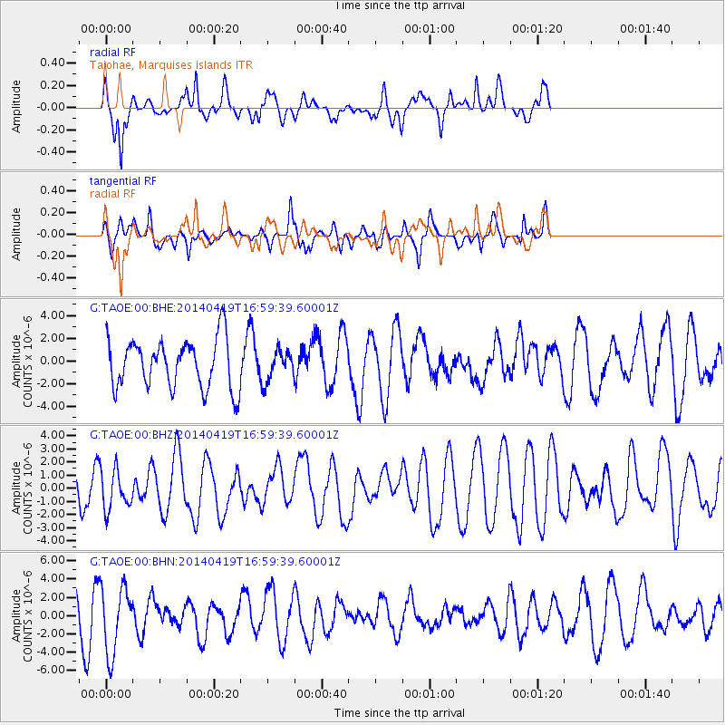
TAOE Taiohae, Marquises islands - Earthquake Result Viewer
*The percent match for this event was below the threshold and hence no stack was calculated.
| Earthquake location: |
Solomon Islands |
| Earthquake latitude/longitude: |
-7.1/154.9 |
| Earthquake time(UTC): |
2014/04/19 (109) 16:49:39 GMT |
| Earthquake Depth: |
41 km |
| Earthquake Magnitude: |
5.2 mb |
| Earthquake Catalog/Contributor: |
ISC/ISC |
|
| Network: |
G GEOSCOPE |
| Station: |
TAOE Taiohae, Marquises islands |
| Lat/Lon: |
8.85 S/140.15 W |
| Elevation: |
800 m |
|
| Distance: |
64.3 deg |
| Az: |
96.41 deg |
| Baz: |
266.386 deg |
| Ray Param: |
$rayparam |
*The percent match for this event was below the threshold and hence was not used in the summary stack. |
|
| Radial Match: |
56.31959 % |
| Radial Bump: |
400 |
| Transverse Match: |
46.420395 % |
| Transverse Bump: |
328 |
| SOD ConfigId: |
3390531 |
| Insert Time: |
2019-04-11 12:23:50.507 +0000 |
| GWidth: |
2.5 |
| Max Bumps: |
400 |
| Tol: |
0.001 |
|
Signal To Noise
| Channel | StoN | STA | LTA |
| G:TAOE:00:BHZ:20140419T16:59:39.60001Z | 0.8347345 | 1.4886035E-6 | 1.7833257E-6 |
| G:TAOE:00:BHN:20140419T16:59:39.60001Z | 1.8240575 | 3.7336672E-6 | 2.0469022E-6 |
| G:TAOE:00:BHE:20140419T16:59:39.60001Z | 0.61512005 | 1.3376701E-6 | 2.1746487E-6 |
| Arrivals |
| Ps | |
| PpPs | |
| PsPs/PpSs | |


