You are here: Home > Network List > TA - USArray Transportable Network (new EarthScope stations) Stations List
> Station N38A Joe's South Fork Station, Corydon, IA, USA > Earthquake Result Viewer
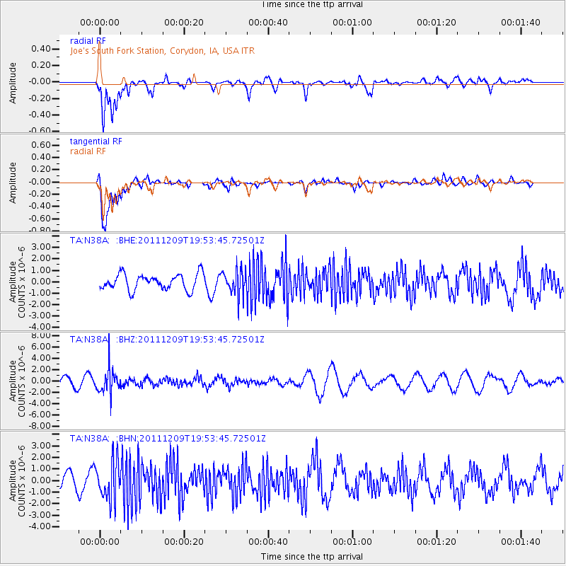
N38A Joe's South Fork Station, Corydon, IA, USA - Earthquake Result Viewer
*The percent match for this event was below the threshold and hence no stack was calculated.
| Earthquake location: |
Sea Of Okhotsk |
| Earthquake latitude/longitude: |
47.0/144.6 |
| Earthquake time(UTC): |
2011/12/09 (343) 19:42:57 GMT |
| Earthquake Depth: |
392 km |
| Earthquake Magnitude: |
5.7 MB, 5.7 MW, 5.8 MW |
| Earthquake Catalog/Contributor: |
WHDF/NEIC |
|
| Network: |
TA USArray Transportable Network (new EarthScope stations) |
| Station: |
N38A Joe's South Fork Station, Corydon, IA, USA |
| Lat/Lon: |
40.79 N/93.24 W |
| Elevation: |
317 m |
|
| Distance: |
78.6 deg |
| Az: |
40.941 deg |
| Baz: |
323.798 deg |
| Ray Param: |
$rayparam |
*The percent match for this event was below the threshold and hence was not used in the summary stack. |
|
| Radial Match: |
43.540714 % |
| Radial Bump: |
400 |
| Transverse Match: |
86.886696 % |
| Transverse Bump: |
400 |
| SOD ConfigId: |
432046 |
| Insert Time: |
2012-03-08 01:19:09.765 +0000 |
| GWidth: |
2.5 |
| Max Bumps: |
400 |
| Tol: |
0.001 |
|
Signal To Noise
| Channel | StoN | STA | LTA |
| TA:N38A: :BHZ:20111209T19:53:45.72501Z | 2.1686597 | 2.0589298E-6 | 9.49402E-7 |
| TA:N38A: :BHN:20111209T19:53:45.72501Z | 1.6787395 | 1.6886739E-6 | 1.0059177E-6 |
| TA:N38A: :BHE:20111209T19:53:45.72501Z | 1.5136892 | 1.0382319E-6 | 6.8589503E-7 |
| Arrivals |
| Ps | |
| PpPs | |
| PsPs/PpSs | |


