You are here: Home > Network List > UW - Pacific Northwest Regional Seismic Network Stations List
> Station UMAT Pilot Rock, OR, USA > Earthquake Result Viewer
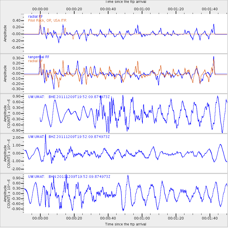
UMAT Pilot Rock, OR, USA - Earthquake Result Viewer
*The percent match for this event was below the threshold and hence no stack was calculated.
| Earthquake location: |
Sea Of Okhotsk |
| Earthquake latitude/longitude: |
47.0/144.6 |
| Earthquake time(UTC): |
2011/12/09 (343) 19:42:57 GMT |
| Earthquake Depth: |
392 km |
| Earthquake Magnitude: |
5.7 MB, 5.7 MW, 5.8 MW |
| Earthquake Catalog/Contributor: |
WHDF/NEIC |
|
| Network: |
UW Pacific Northwest Regional Seismic Network |
| Station: |
UMAT Pilot Rock, OR, USA |
| Lat/Lon: |
45.29 N/118.96 W |
| Elevation: |
1318 m |
|
| Distance: |
62.5 deg |
| Az: |
52.258 deg |
| Baz: |
309.949 deg |
| Ray Param: |
$rayparam |
*The percent match for this event was below the threshold and hence was not used in the summary stack. |
|
| Radial Match: |
49.128677 % |
| Radial Bump: |
396 |
| Transverse Match: |
60.558746 % |
| Transverse Bump: |
400 |
| SOD ConfigId: |
432046 |
| Insert Time: |
2012-03-08 01:24:34.934 +0000 |
| GWidth: |
2.5 |
| Max Bumps: |
400 |
| Tol: |
0.001 |
|
Signal To Noise
| Channel | StoN | STA | LTA |
| UW:UMAT: :BHZ:20111209T19:52:09.874973Z | 2.2272308 | 8.3305235E-7 | 3.7403058E-7 |
| UW:UMAT: :BHN:20111209T19:52:09.874973Z | 1.4078269 | 3.9799917E-7 | 2.8270463E-7 |
| UW:UMAT: :BHE:20111209T19:52:09.874973Z | 1.0114042 | 3.235127E-7 | 3.198649E-7 |
| Arrivals |
| Ps | |
| PpPs | |
| PsPs/PpSs | |


