You are here: Home > Network List > CI - Caltech Regional Seismic Network Stations List
> Station MPM Manuel Prospect Mine, California, USA > Earthquake Result Viewer
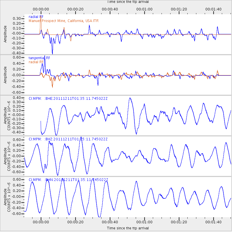
MPM Manuel Prospect Mine, California, USA - Earthquake Result Viewer
*The percent match for this event was below the threshold and hence no stack was calculated.
| Earthquake location: |
Ryukyu Islands, Japan |
| Earthquake latitude/longitude: |
28.1/129.4 |
| Earthquake time(UTC): |
2011/12/11 (345) 01:22:45 GMT |
| Earthquake Depth: |
38 km |
| Earthquake Magnitude: |
5.7 MB, 5.3 MW, 5.4 MW |
| Earthquake Catalog/Contributor: |
WHDF/NEIC |
|
| Network: |
CI Caltech Regional Seismic Network |
| Station: |
MPM Manuel Prospect Mine, California, USA |
| Lat/Lon: |
36.06 N/117.49 W |
| Elevation: |
185 m |
|
| Distance: |
90.4 deg |
| Az: |
48.167 deg |
| Baz: |
305.677 deg |
| Ray Param: |
$rayparam |
*The percent match for this event was below the threshold and hence was not used in the summary stack. |
|
| Radial Match: |
43.318783 % |
| Radial Bump: |
400 |
| Transverse Match: |
80.54093 % |
| Transverse Bump: |
359 |
| SOD ConfigId: |
434841 |
| Insert Time: |
2012-03-10 05:17:30.809 +0000 |
| GWidth: |
2.5 |
| Max Bumps: |
400 |
| Tol: |
0.001 |
|
Signal To Noise
| Channel | StoN | STA | LTA |
| CI:MPM: :BHZ:20111211T01:35:11.745022Z | 1.1612113 | 3.7242376E-7 | 3.2072006E-7 |
| CI:MPM: :BHN:20111211T01:35:11.745022Z | 1.638206 | 4.3547067E-7 | 2.6582165E-7 |
| CI:MPM: :BHE:20111211T01:35:11.745022Z | 0.8944233 | 1.7554044E-7 | 1.9626103E-7 |
| Arrivals |
| Ps | |
| PpPs | |
| PsPs/PpSs | |


