You are here: Home > Network List > IU - Global Seismograph Network (GSN - IRIS/USGS) Stations List
> Station GRFO Grafenberg, Germany > Earthquake Result Viewer
GRFO Grafenberg, Germany - Earthquake Result Viewer
*The percent match for this event was below the threshold and hence no stack was calculated.
| Earthquake location: |
Ryukyu Islands, Japan |
| Earthquake latitude/longitude: |
28.1/129.4 |
| Earthquake time(UTC): |
2011/12/11 (345) 01:22:45 GMT |
| Earthquake Depth: |
38 km |
| Earthquake Magnitude: |
5.7 MB, 5.3 MW, 5.4 MW |
| Earthquake Catalog/Contributor: |
WHDF/NEIC |
|
| Network: |
IU Global Seismograph Network (GSN - IRIS/USGS) |
| Station: |
GRFO Grafenberg, Germany |
| Lat/Lon: |
49.69 N/11.22 E |
| Elevation: |
384 m |
|
| Distance: |
85.1 deg |
| Az: |
324.917 deg |
| Baz: |
51.428 deg |
| Ray Param: |
$rayparam |
*The percent match for this event was below the threshold and hence was not used in the summary stack. |
|
| Radial Match: |
56.354458 % |
| Radial Bump: |
400 |
| Transverse Match: |
54.413704 % |
| Transverse Bump: |
400 |
| SOD ConfigId: |
434841 |
| Insert Time: |
2012-03-10 05:19:50.449 +0000 |
| GWidth: |
2.5 |
| Max Bumps: |
400 |
| Tol: |
0.001 |
|
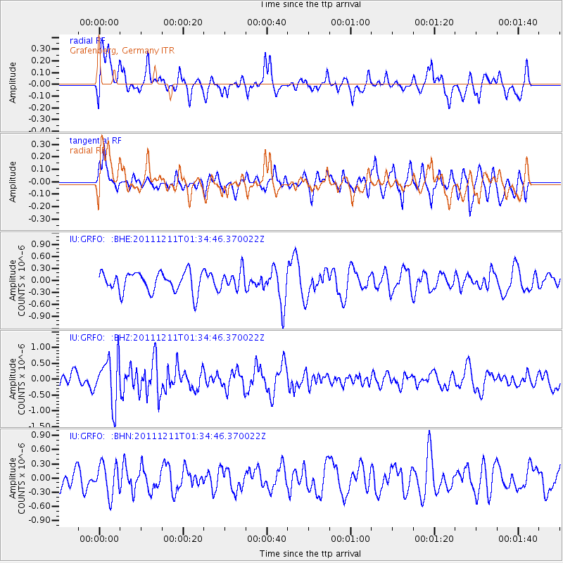
Signal To Noise
| Channel | StoN | STA | LTA |
| IU:GRFO: :BHZ:20111211T01:34:46.370022Z | 2.9304252 | 7.432454E-7 | 2.5363056E-7 |
| IU:GRFO: :BHN:20111211T01:34:46.370022Z | 1.4629761 | 3.35471E-7 | 2.2930722E-7 |
| IU:GRFO: :BHE:20111211T01:34:46.370022Z | 0.9211367 | 2.3051328E-7 | 2.5024872E-7 |
| Arrivals |
| Ps | |
| PpPs | |
| PsPs/PpSs | |


