You are here: Home > Network List > TA - USArray Transportable Network (new EarthScope stations) Stations List
> Station J01E Myrtle Point, OR, USA > Earthquake Result Viewer
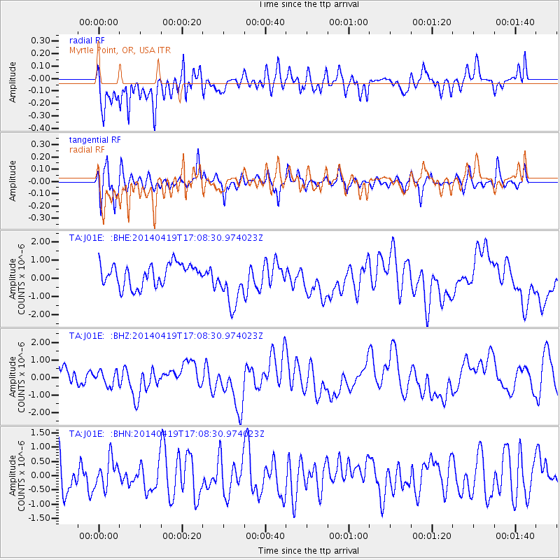
J01E Myrtle Point, OR, USA - Earthquake Result Viewer
*The percent match for this event was below the threshold and hence no stack was calculated.
| Earthquake location: |
Solomon Islands |
| Earthquake latitude/longitude: |
-6.9/154.7 |
| Earthquake time(UTC): |
2014/04/19 (109) 16:56:14 GMT |
| Earthquake Depth: |
39 km |
| Earthquake Magnitude: |
5.2 mb |
| Earthquake Catalog/Contributor: |
ISC/ISC |
|
| Network: |
TA USArray Transportable Network (new EarthScope stations) |
| Station: |
J01E Myrtle Point, OR, USA |
| Lat/Lon: |
43.16 N/123.93 W |
| Elevation: |
128 m |
|
| Distance: |
88.4 deg |
| Az: |
46.36 deg |
| Baz: |
259.073 deg |
| Ray Param: |
$rayparam |
*The percent match for this event was below the threshold and hence was not used in the summary stack. |
|
| Radial Match: |
65.675606 % |
| Radial Bump: |
400 |
| Transverse Match: |
53.042637 % |
| Transverse Bump: |
375 |
| SOD ConfigId: |
3390531 |
| Insert Time: |
2019-04-11 12:29:28.378 +0000 |
| GWidth: |
2.5 |
| Max Bumps: |
400 |
| Tol: |
0.001 |
|
Signal To Noise
| Channel | StoN | STA | LTA |
| TA:J01E: :BHZ:20140419T17:08:30.974023Z | 0.54704696 | 4.3457987E-7 | 7.9441054E-7 |
| TA:J01E: :BHN:20140419T17:08:30.974023Z | 0.71410453 | 5.091375E-7 | 7.129733E-7 |
| TA:J01E: :BHE:20140419T17:08:30.974023Z | 2.184453 | 1.3231681E-6 | 6.0572063E-7 |
| Arrivals |
| Ps | |
| PpPs | |
| PsPs/PpSs | |


