You are here: Home > Network List > TA - USArray Transportable Network (new EarthScope stations) Stations List
> Station L02D Cave Junction, OR, USA > Earthquake Result Viewer
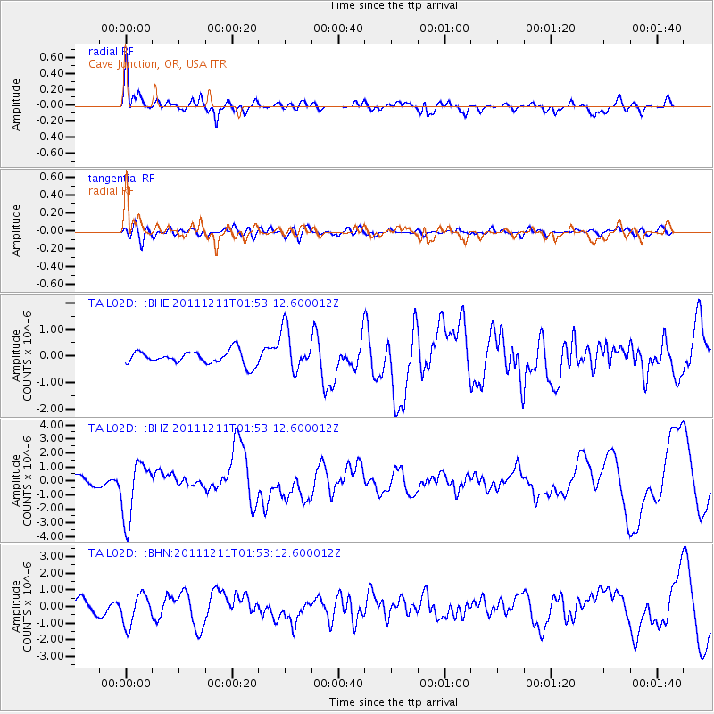
L02D Cave Junction, OR, USA - Earthquake Result Viewer
*The percent match for this event was below the threshold and hence no stack was calculated.
| Earthquake location: |
Guerrero, Mexico |
| Earthquake latitude/longitude: |
17.8/-100.0 |
| Earthquake time(UTC): |
2011/12/11 (345) 01:47:25 GMT |
| Earthquake Depth: |
54 km |
| Earthquake Magnitude: |
6.2 MB, 6.5 MW, 6.5 MW |
| Earthquake Catalog/Contributor: |
WHDF/NEIC |
|
| Network: |
TA USArray Transportable Network (new EarthScope stations) |
| Station: |
L02D Cave Junction, OR, USA |
| Lat/Lon: |
42.16 N/123.60 W |
| Elevation: |
458 m |
|
| Distance: |
31.5 deg |
| Az: |
325.231 deg |
| Baz: |
133.069 deg |
| Ray Param: |
$rayparam |
*The percent match for this event was below the threshold and hence was not used in the summary stack. |
|
| Radial Match: |
72.26761 % |
| Radial Bump: |
400 |
| Transverse Match: |
34.203247 % |
| Transverse Bump: |
400 |
| SOD ConfigId: |
434841 |
| Insert Time: |
2012-03-10 05:43:47.056 +0000 |
| GWidth: |
2.5 |
| Max Bumps: |
400 |
| Tol: |
0.001 |
|
Signal To Noise
| Channel | StoN | STA | LTA |
| TA:L02D: :BHZ:20111211T01:53:12.600012Z | 4.5332193 | 2.082188E-6 | 4.5931776E-7 |
| TA:L02D: :BHN:20111211T01:53:12.600012Z | 2.0695617 | 9.2941036E-7 | 4.4908558E-7 |
| TA:L02D: :BHE:20111211T01:53:12.600012Z | 3.2164648 | 8.0966214E-7 | 2.5172423E-7 |
| Arrivals |
| Ps | |
| PpPs | |
| PsPs/PpSs | |


