You are here: Home > Network List > TA - USArray Transportable Network (new EarthScope stations) Stations List
> Station A33A Warroad, MN, USA > Earthquake Result Viewer
A33A Warroad, MN, USA - Earthquake Result Viewer

| Earthquake location: |
Guerrero, Mexico |
| Earthquake latitude/longitude: |
17.8/-100.0 |
| Earthquake time(UTC): |
2011/12/11 (345) 01:47:25 GMT |
| Earthquake Depth: |
54 km |
| Earthquake Magnitude: |
6.2 MB, 6.5 MW, 6.5 MW |
| Earthquake Catalog/Contributor: |
WHDF/NEIC |
|
| Network: |
TA USArray Transportable Network (new EarthScope stations) |
| Station: |
A33A Warroad, MN, USA |
| Lat/Lon: |
48.94 N/95.39 W |
| Elevation: |
329 m |
|
| Distance: |
31.2 deg |
| Az: |
5.818 deg |
| Baz: |
188.42 deg |
| Ray Param: |
0.07904677 |
| Estimated Moho Depth: |
34.25 km |
| Estimated Crust Vp/Vs: |
2.09 |
| Assumed Crust Vp: |
6.419 km/s |
| Estimated Crust Vs: |
3.079 km/s |
| Estimated Crust Poisson's Ratio: |
0.35 |
|
| Radial Match: |
88.858 % |
| Radial Bump: |
345 |
| Transverse Match: |
56.2533 % |
| Transverse Bump: |
400 |
| SOD ConfigId: |
434841 |
| Insert Time: |
2012-03-10 05:47:09.785 +0000 |
| GWidth: |
2.5 |
| Max Bumps: |
400 |
| Tol: |
0.001 |
|
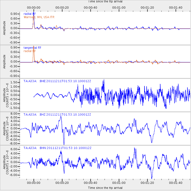
Signal To Noise
| Channel | StoN | STA | LTA |
| TA:A33A: :BHZ:20111211T01:53:10.100012Z | 4.4512434 | 1.4491702E-6 | 3.2556528E-7 |
| TA:A33A: :BHN:20111211T01:53:10.100012Z | 4.9602275 | 1.0834469E-6 | 2.1842686E-7 |
| TA:A33A: :BHE:20111211T01:53:10.100012Z | 3.0803201 | 4.991284E-7 | 1.6203785E-7 |
| Arrivals |
| Ps | 6.2 SECOND |
| PpPs | 15 SECOND |
| PsPs/PpSs | 22 SECOND |


