
HYB Hyderabad, India - Earthquake Result Viewer
| ||||||||||||||||||
| ||||||||||||||||||
| ||||||||||||||||||
|
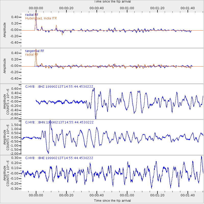
Signal To Noise
| Channel | StoN | STA | LTA |
| G:HYB: :BHN:19990213T14:55:44.453022Z | 3.8158677 | 3.233556E-7 | 8.473974E-8 |
| G:HYB: :BHE:19990213T14:55:44.453022Z | 1.2338196 | 4.198546E-8 | 3.4028847E-8 |
| G:HYB: :BHZ:19990213T14:55:44.453022Z | 2.4877105 | 1.1213459E-7 | 4.5075417E-8 |
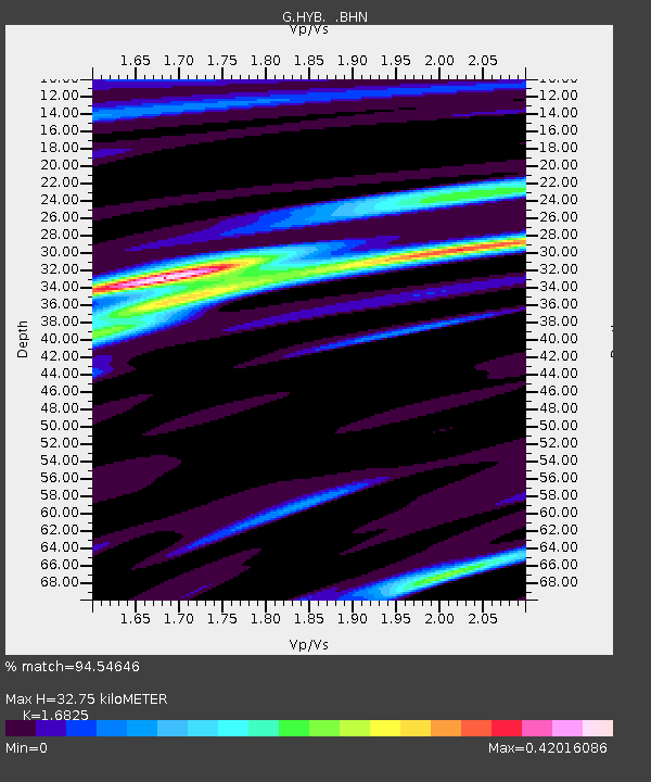
| Arrivals | |
| Ps | 3.6 SECOND |
| PpPs | 13 SECOND |
| PsPs/PpSs | 17 SECOND |

