You are here: Home > Network List > TA - USArray Transportable Network (new EarthScope stations) Stations List
> Station T25A Trinidad, CO, USA > Earthquake Result Viewer
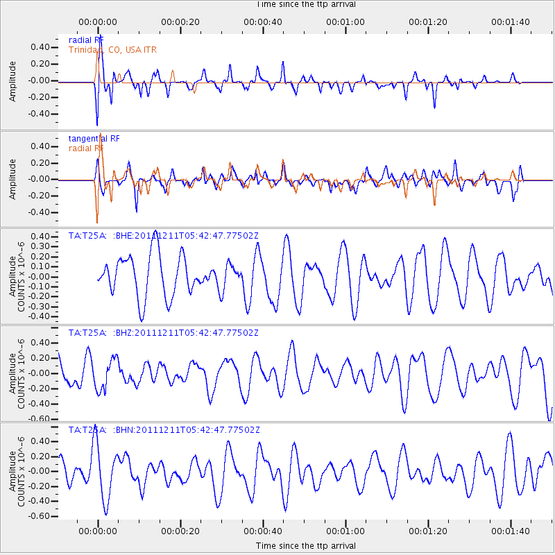
T25A Trinidad, CO, USA - Earthquake Result Viewer
*The percent match for this event was below the threshold and hence no stack was calculated.
| Earthquake location: |
South Of Fiji Islands |
| Earthquake latitude/longitude: |
-24.1/178.6 |
| Earthquake time(UTC): |
2011/12/11 (345) 05:30:57 GMT |
| Earthquake Depth: |
556 km |
| Earthquake Magnitude: |
5.6 MW, 5.4 MB |
| Earthquake Catalog/Contributor: |
WHDF/NEIC |
|
| Network: |
TA USArray Transportable Network (new EarthScope stations) |
| Station: |
T25A Trinidad, CO, USA |
| Lat/Lon: |
37.14 N/104.41 W |
| Elevation: |
2017 m |
|
| Distance: |
94.6 deg |
| Az: |
51.376 deg |
| Baz: |
243.322 deg |
| Ray Param: |
$rayparam |
*The percent match for this event was below the threshold and hence was not used in the summary stack. |
|
| Radial Match: |
65.6578 % |
| Radial Bump: |
400 |
| Transverse Match: |
53.76398 % |
| Transverse Bump: |
400 |
| SOD ConfigId: |
434841 |
| Insert Time: |
2012-03-10 06:08:55.009 +0000 |
| GWidth: |
2.5 |
| Max Bumps: |
400 |
| Tol: |
0.001 |
|
Signal To Noise
| Channel | StoN | STA | LTA |
| TA:T25A: :BHZ:20111211T05:42:47.77502Z | 0.8244109 | 2.0298562E-7 | 2.4621897E-7 |
| TA:T25A: :BHN:20111211T05:42:47.77502Z | 2.8077066 | 3.7672336E-7 | 1.3417475E-7 |
| TA:T25A: :BHE:20111211T05:42:47.77502Z | 0.61687046 | 1.3062545E-7 | 2.1175507E-7 |
| Arrivals |
| Ps | |
| PpPs | |
| PsPs/PpSs | |


