You are here: Home > Network List > TA - USArray Transportable Network (new EarthScope stations) Stations List
> Station O02D Mt. Diablo Meridian, CA, USA > Earthquake Result Viewer
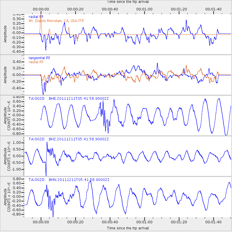
O02D Mt. Diablo Meridian, CA, USA - Earthquake Result Viewer
*The percent match for this event was below the threshold and hence no stack was calculated.
| Earthquake location: |
South Of Fiji Islands |
| Earthquake latitude/longitude: |
-24.1/178.6 |
| Earthquake time(UTC): |
2011/12/11 (345) 05:30:57 GMT |
| Earthquake Depth: |
556 km |
| Earthquake Magnitude: |
5.6 MW, 5.4 MB |
| Earthquake Catalog/Contributor: |
WHDF/NEIC |
|
| Network: |
TA USArray Transportable Network (new EarthScope stations) |
| Station: |
O02D Mt. Diablo Meridian, CA, USA |
| Lat/Lon: |
40.18 N/122.79 W |
| Elevation: |
965 m |
|
| Distance: |
84.1 deg |
| Az: |
41.141 deg |
| Baz: |
231.703 deg |
| Ray Param: |
$rayparam |
*The percent match for this event was below the threshold and hence was not used in the summary stack. |
|
| Radial Match: |
67.80529 % |
| Radial Bump: |
400 |
| Transverse Match: |
58.961254 % |
| Transverse Bump: |
400 |
| SOD ConfigId: |
434841 |
| Insert Time: |
2012-03-10 06:09:22.946 +0000 |
| GWidth: |
2.5 |
| Max Bumps: |
400 |
| Tol: |
0.001 |
|
Signal To Noise
| Channel | StoN | STA | LTA |
| TA:O02D: :BHZ:20111211T05:41:58.90002Z | 2.6632736 | 5.288931E-7 | 1.985876E-7 |
| TA:O02D: :BHN:20111211T05:41:58.90002Z | 1.0489379 | 3.4627794E-7 | 3.3012245E-7 |
| TA:O02D: :BHE:20111211T05:41:58.90002Z | 0.6570368 | 2.3418457E-7 | 3.5642535E-7 |
| Arrivals |
| Ps | |
| PpPs | |
| PsPs/PpSs | |


