You are here: Home > Network List > TA - USArray Transportable Network (new EarthScope stations) Stations List
> Station O03D Paynes Creek, CA, USA > Earthquake Result Viewer
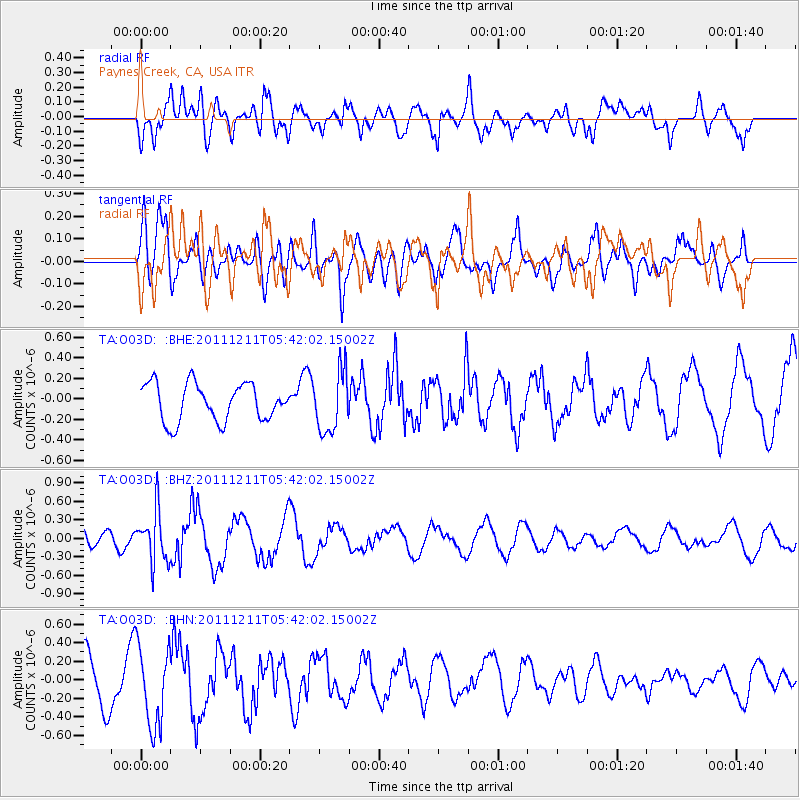
O03D Paynes Creek, CA, USA - Earthquake Result Viewer
*The percent match for this event was below the threshold and hence no stack was calculated.
| Earthquake location: |
South Of Fiji Islands |
| Earthquake latitude/longitude: |
-24.1/178.6 |
| Earthquake time(UTC): |
2011/12/11 (345) 05:30:57 GMT |
| Earthquake Depth: |
556 km |
| Earthquake Magnitude: |
5.6 MW, 5.4 MB |
| Earthquake Catalog/Contributor: |
WHDF/NEIC |
|
| Network: |
TA USArray Transportable Network (new EarthScope stations) |
| Station: |
O03D Paynes Creek, CA, USA |
| Lat/Lon: |
40.29 N/121.80 W |
| Elevation: |
968 m |
|
| Distance: |
84.7 deg |
| Az: |
41.514 deg |
| Baz: |
232.375 deg |
| Ray Param: |
$rayparam |
*The percent match for this event was below the threshold and hence was not used in the summary stack. |
|
| Radial Match: |
60.028297 % |
| Radial Bump: |
400 |
| Transverse Match: |
51.35236 % |
| Transverse Bump: |
400 |
| SOD ConfigId: |
434841 |
| Insert Time: |
2012-03-10 06:09:23.905 +0000 |
| GWidth: |
2.5 |
| Max Bumps: |
400 |
| Tol: |
0.001 |
|
Signal To Noise
| Channel | StoN | STA | LTA |
| TA:O03D: :BHZ:20111211T05:42:02.15002Z | 2.631015 | 4.1347525E-7 | 1.5715426E-7 |
| TA:O03D: :BHN:20111211T05:42:02.15002Z | 1.4285675 | 4.2881666E-7 | 3.0017247E-7 |
| TA:O03D: :BHE:20111211T05:42:02.15002Z | 1.6187416 | 2.9533095E-7 | 1.8244477E-7 |
| Arrivals |
| Ps | |
| PpPs | |
| PsPs/PpSs | |


