You are here: Home > Network List > UW - Pacific Northwest Regional Seismic Network Stations List
> Station YACT Amboy, WA, USA > Earthquake Result Viewer
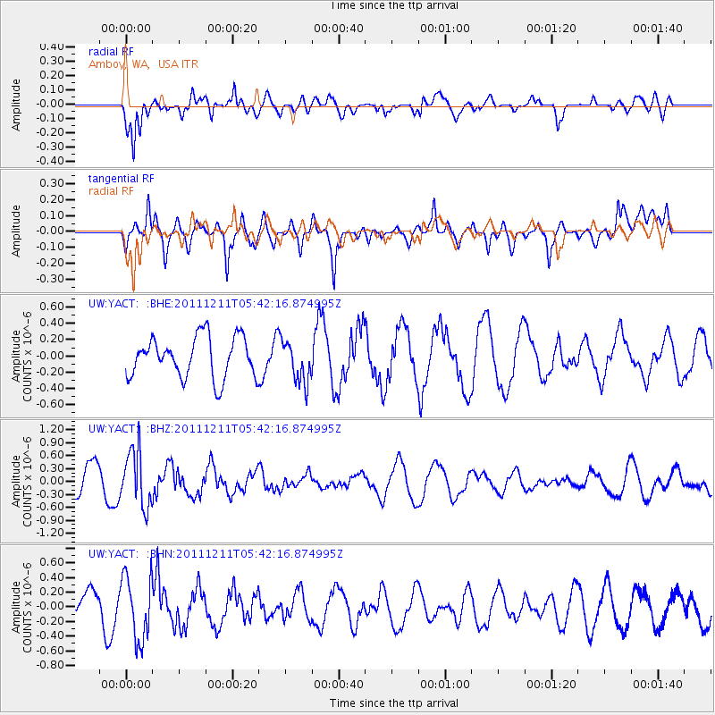
YACT Amboy, WA, USA - Earthquake Result Viewer
*The percent match for this event was below the threshold and hence no stack was calculated.
| Earthquake location: |
South Of Fiji Islands |
| Earthquake latitude/longitude: |
-24.1/178.6 |
| Earthquake time(UTC): |
2011/12/11 (345) 05:30:57 GMT |
| Earthquake Depth: |
556 km |
| Earthquake Magnitude: |
5.6 MW, 5.4 MB |
| Earthquake Catalog/Contributor: |
WHDF/NEIC |
|
| Network: |
UW Pacific Northwest Regional Seismic Network |
| Station: |
YACT Amboy, WA, USA |
| Lat/Lon: |
45.93 N/122.42 W |
| Elevation: |
211 m |
|
| Distance: |
87.8 deg |
| Az: |
36.786 deg |
| Baz: |
231.647 deg |
| Ray Param: |
$rayparam |
*The percent match for this event was below the threshold and hence was not used in the summary stack. |
|
| Radial Match: |
85.12032 % |
| Radial Bump: |
400 |
| Transverse Match: |
76.44084 % |
| Transverse Bump: |
400 |
| SOD ConfigId: |
434841 |
| Insert Time: |
2012-03-10 06:10:58.952 +0000 |
| GWidth: |
2.5 |
| Max Bumps: |
400 |
| Tol: |
0.001 |
|
Signal To Noise
| Channel | StoN | STA | LTA |
| UW:YACT: :BHZ:20111211T05:42:16.874995Z | 1.6168636 | 6.5753727E-7 | 4.0667456E-7 |
| UW:YACT: :BHN:20111211T05:42:16.874995Z | 1.8868483 | 4.393369E-7 | 2.3284167E-7 |
| UW:YACT: :BHE:20111211T05:42:16.874995Z | 1.0144829 | 2.5317289E-7 | 2.4955855E-7 |
| Arrivals |
| Ps | |
| PpPs | |
| PsPs/PpSs | |


