You are here: Home > Network List > TA - USArray Transportable Network (new EarthScope stations) Stations List
> Station J01E Myrtle Point, OR, USA > Earthquake Result Viewer
J01E Myrtle Point, OR, USA - Earthquake Result Viewer
*The percent match for this event was below the threshold and hence no stack was calculated.
| Earthquake location: |
Solomon Islands |
| Earthquake latitude/longitude: |
-7.0/155.0 |
| Earthquake time(UTC): |
2014/04/19 (109) 17:45:11 GMT |
| Earthquake Depth: |
41 km |
| Earthquake Magnitude: |
5.3 mb |
| Earthquake Catalog/Contributor: |
ISC/ISC |
|
| Network: |
TA USArray Transportable Network (new EarthScope stations) |
| Station: |
J01E Myrtle Point, OR, USA |
| Lat/Lon: |
43.16 N/123.93 W |
| Elevation: |
128 m |
|
| Distance: |
88.3 deg |
| Az: |
46.322 deg |
| Baz: |
258.836 deg |
| Ray Param: |
$rayparam |
*The percent match for this event was below the threshold and hence was not used in the summary stack. |
|
| Radial Match: |
51.135696 % |
| Radial Bump: |
400 |
| Transverse Match: |
42.274708 % |
| Transverse Bump: |
400 |
| SOD ConfigId: |
3390531 |
| Insert Time: |
2019-04-11 12:36:52.459 +0000 |
| GWidth: |
2.5 |
| Max Bumps: |
400 |
| Tol: |
0.001 |
|
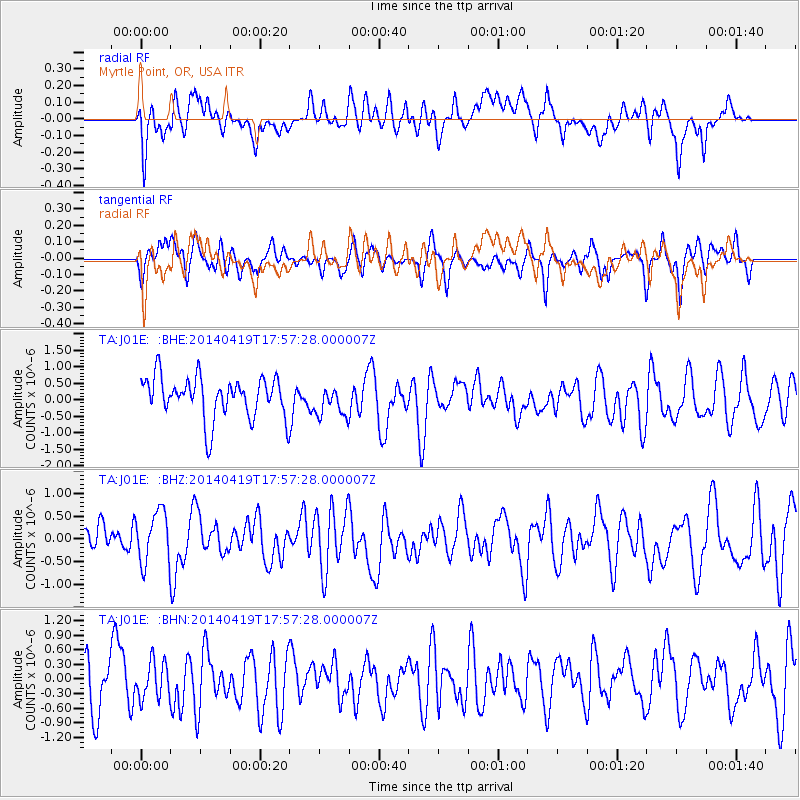
Signal To Noise
| Channel | StoN | STA | LTA |
| TA:J01E: :BHZ:20140419T17:57:28.000007Z | 0.7430766 | 5.7424995E-7 | 7.7280043E-7 |
| TA:J01E: :BHN:20140419T17:57:28.000007Z | 0.7590998 | 3.770896E-7 | 4.9675896E-7 |
| TA:J01E: :BHE:20140419T17:57:28.000007Z | 0.74692446 | 4.6807958E-7 | 6.2667596E-7 |
| Arrivals |
| Ps | |
| PpPs | |
| PsPs/PpSs | |


