You are here: Home > Network List > G - GEOSCOPE Stations List
> Station UNM Unam,Mexico > Earthquake Result Viewer
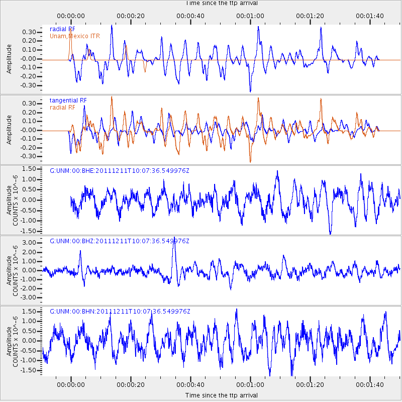
UNM Unam,Mexico - Earthquake Result Viewer
*The percent match for this event was below the threshold and hence no stack was calculated.
| Earthquake location: |
South Sandwich Islands Region |
| Earthquake latitude/longitude: |
-56.0/-28.2 |
| Earthquake time(UTC): |
2011/12/11 (345) 09:54:55 GMT |
| Earthquake Depth: |
116 km |
| Earthquake Magnitude: |
6.1 MB, 6.2 MW, 6.2 MW |
| Earthquake Catalog/Contributor: |
WHDF/NEIC |
|
| Network: |
G GEOSCOPE |
| Station: |
UNM Unam,Mexico |
| Lat/Lon: |
19.33 N/99.18 W |
| Elevation: |
2280 m |
|
| Distance: |
95.7 deg |
| Az: |
296.195 deg |
| Baz: |
147.746 deg |
| Ray Param: |
$rayparam |
*The percent match for this event was below the threshold and hence was not used in the summary stack. |
|
| Radial Match: |
67.0872 % |
| Radial Bump: |
400 |
| Transverse Match: |
72.566216 % |
| Transverse Bump: |
400 |
| SOD ConfigId: |
434841 |
| Insert Time: |
2012-03-10 06:19:45.195 +0000 |
| GWidth: |
2.5 |
| Max Bumps: |
400 |
| Tol: |
0.001 |
|
Signal To Noise
| Channel | StoN | STA | LTA |
| G:UNM:00:BHZ:20111211T10:07:36.549976Z | 2.3071358 | 7.812908E-7 | 3.38641E-7 |
| G:UNM:00:BHN:20111211T10:07:36.549976Z | 0.8681795 | 5.4425675E-7 | 6.268943E-7 |
| G:UNM:00:BHE:20111211T10:07:36.549976Z | 1.0296437 | 3.7355872E-7 | 3.6280392E-7 |
| Arrivals |
| Ps | |
| PpPs | |
| PsPs/PpSs | |


