You are here: Home > Network List > UW - Pacific Northwest Regional Seismic Network Stations List
> Station PASS Maple Falls, WA, USA > Earthquake Result Viewer
PASS Maple Falls, WA, USA - Earthquake Result Viewer

| Earthquake location: |
Solomon Islands |
| Earthquake latitude/longitude: |
-7.0/155.0 |
| Earthquake time(UTC): |
2014/04/19 (109) 17:45:11 GMT |
| Earthquake Depth: |
41 km |
| Earthquake Magnitude: |
5.3 mb |
| Earthquake Catalog/Contributor: |
ISC/ISC |
|
| Network: |
UW Pacific Northwest Regional Seismic Network |
| Station: |
PASS Maple Falls, WA, USA |
| Lat/Lon: |
49.00 N/122.09 W |
| Elevation: |
174 m |
|
| Distance: |
90.6 deg |
| Az: |
40.818 deg |
| Baz: |
260.114 deg |
| Ray Param: |
0.04165279 |
| Estimated Moho Depth: |
68.0 km |
| Estimated Crust Vp/Vs: |
1.89 |
| Assumed Crust Vp: |
6.566 km/s |
| Estimated Crust Vs: |
3.479 km/s |
| Estimated Crust Poisson's Ratio: |
0.30 |
|
| Radial Match: |
81.698524 % |
| Radial Bump: |
400 |
| Transverse Match: |
87.147 % |
| Transverse Bump: |
375 |
| SOD ConfigId: |
3390531 |
| Insert Time: |
2019-04-11 12:37:24.384 +0000 |
| GWidth: |
2.5 |
| Max Bumps: |
400 |
| Tol: |
0.001 |
|
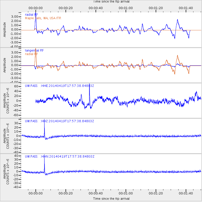
Signal To Noise
| Channel | StoN | STA | LTA |
| UW:PASS: :HHZ:20140419T17:57:38.84803Z | 0.9087283 | 3.103732E-6 | 3.4154677E-6 |
| UW:PASS: :HHN:20140419T17:57:38.84803Z | 0.88340604 | 3.2502778E-6 | 3.679257E-6 |
| UW:PASS: :HHE:20140419T17:57:38.84803Z | 2.030115 | 2.0485459E-5 | 1.0090788E-5 |
| Arrivals |
| Ps | 9.4 SECOND |
| PpPs | 29 SECOND |
| PsPs/PpSs | 39 SECOND |


