You are here: Home > Network List > G - GEOSCOPE Stations List
> Station ATD Arta Cave - Arta, Republic of Djibouti > Earthquake Result Viewer
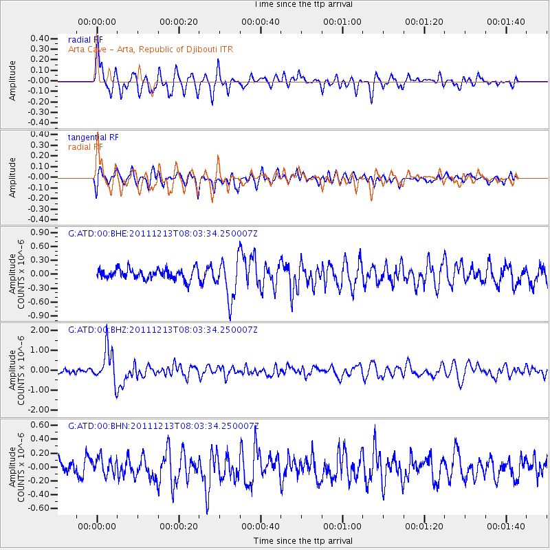
ATD Arta Cave - Arta, Republic of Djibouti - Earthquake Result Viewer
*The percent match for this event was below the threshold and hence no stack was calculated.
| Earthquake location: |
Minahassa Peninsula, Sulawesi |
| Earthquake latitude/longitude: |
0.0/123.0 |
| Earthquake time(UTC): |
2011/12/13 (347) 07:52:11 GMT |
| Earthquake Depth: |
161 km |
| Earthquake Magnitude: |
6.3 MB, 6.0 MW, 6.0 MW |
| Earthquake Catalog/Contributor: |
WHDF/NEIC |
|
| Network: |
G GEOSCOPE |
| Station: |
ATD Arta Cave - Arta, Republic of Djibouti |
| Lat/Lon: |
11.53 N/42.85 E |
| Elevation: |
610 m |
|
| Distance: |
80.4 deg |
| Az: |
281.614 deg |
| Baz: |
91.928 deg |
| Ray Param: |
$rayparam |
*The percent match for this event was below the threshold and hence was not used in the summary stack. |
|
| Radial Match: |
70.37359 % |
| Radial Bump: |
400 |
| Transverse Match: |
50.47169 % |
| Transverse Bump: |
400 |
| SOD ConfigId: |
434841 |
| Insert Time: |
2012-03-10 06:31:48.077 +0000 |
| GWidth: |
2.5 |
| Max Bumps: |
400 |
| Tol: |
0.001 |
|
Signal To Noise
| Channel | StoN | STA | LTA |
| G:ATD:00:BHZ:20111213T08:03:34.250007Z | 5.0739417 | 8.9059813E-7 | 1.7552391E-7 |
| G:ATD:00:BHN:20111213T08:03:34.250007Z | 0.9057892 | 1.2591549E-7 | 1.3901192E-7 |
| G:ATD:00:BHE:20111213T08:03:34.250007Z | 3.9890575 | 4.5223388E-7 | 1.1336861E-7 |
| Arrivals |
| Ps | |
| PpPs | |
| PsPs/PpSs | |


