You are here: Home > Network List > CI - Caltech Regional Seismic Network Stations List
> Station SMM Simmler, CA, USA > Earthquake Result Viewer
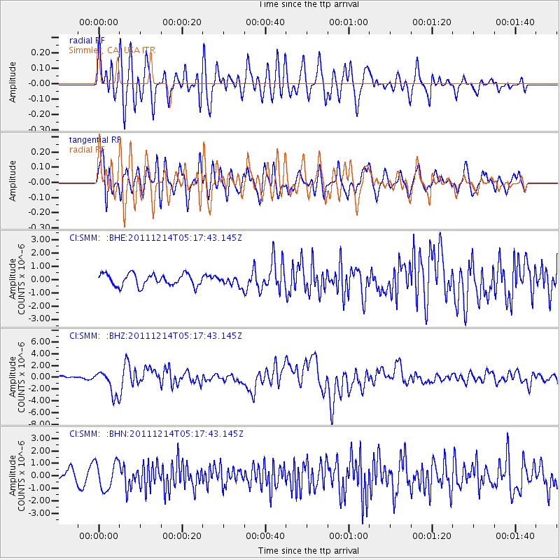
SMM Simmler, CA, USA - Earthquake Result Viewer
*The percent match for this event was below the threshold and hence no stack was calculated.
| Earthquake location: |
Eastern New Guinea Reg., P.N.G. |
| Earthquake latitude/longitude: |
-7.6/146.8 |
| Earthquake time(UTC): |
2011/12/14 (348) 05:04:59 GMT |
| Earthquake Depth: |
141 km |
| Earthquake Magnitude: |
6.6 MB, 7.1 MW, 7.1 MW |
| Earthquake Catalog/Contributor: |
WHDF/NEIC |
|
| Network: |
CI Caltech Regional Seismic Network |
| Station: |
SMM Simmler, CA, USA |
| Lat/Lon: |
35.31 N/120.00 W |
| Elevation: |
599 m |
|
| Distance: |
96.9 deg |
| Az: |
55.34 deg |
| Baz: |
265.664 deg |
| Ray Param: |
$rayparam |
*The percent match for this event was below the threshold and hence was not used in the summary stack. |
|
| Radial Match: |
83.04861 % |
| Radial Bump: |
400 |
| Transverse Match: |
65.36077 % |
| Transverse Bump: |
400 |
| SOD ConfigId: |
434841 |
| Insert Time: |
2012-03-10 06:46:00.404 +0000 |
| GWidth: |
2.5 |
| Max Bumps: |
400 |
| Tol: |
0.001 |
|
Signal To Noise
| Channel | StoN | STA | LTA |
| CI:SMM: :BHZ:20111214T05:17:43.145Z | 5.328245 | 2.1490328E-6 | 4.0332844E-7 |
| CI:SMM: :BHN:20111214T05:17:43.145Z | 1.4199207 | 1.1042181E-6 | 7.776618E-7 |
| CI:SMM: :BHE:20111214T05:17:43.145Z | 0.8598071 | 3.8469187E-7 | 4.4741648E-7 |
| Arrivals |
| Ps | |
| PpPs | |
| PsPs/PpSs | |


