You are here: Home > Network List > TA - USArray Transportable Network (new EarthScope stations) Stations List
> Station L02D Cave Junction, OR, USA > Earthquake Result Viewer
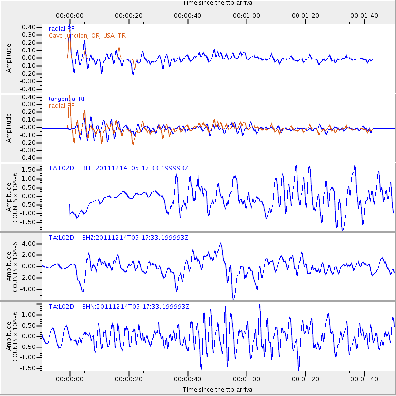
L02D Cave Junction, OR, USA - Earthquake Result Viewer
*The percent match for this event was below the threshold and hence no stack was calculated.
| Earthquake location: |
Eastern New Guinea Reg., P.N.G. |
| Earthquake latitude/longitude: |
-7.6/146.8 |
| Earthquake time(UTC): |
2011/12/14 (348) 05:04:59 GMT |
| Earthquake Depth: |
141 km |
| Earthquake Magnitude: |
6.6 MB, 7.1 MW, 7.1 MW |
| Earthquake Catalog/Contributor: |
WHDF/NEIC |
|
| Network: |
TA USArray Transportable Network (new EarthScope stations) |
| Station: |
L02D Cave Junction, OR, USA |
| Lat/Lon: |
42.16 N/123.60 W |
| Elevation: |
458 m |
|
| Distance: |
94.7 deg |
| Az: |
48.249 deg |
| Baz: |
264.131 deg |
| Ray Param: |
$rayparam |
*The percent match for this event was below the threshold and hence was not used in the summary stack. |
|
| Radial Match: |
73.426834 % |
| Radial Bump: |
400 |
| Transverse Match: |
69.307144 % |
| Transverse Bump: |
400 |
| SOD ConfigId: |
434841 |
| Insert Time: |
2012-03-10 06:49:58.161 +0000 |
| GWidth: |
2.5 |
| Max Bumps: |
400 |
| Tol: |
0.001 |
|
Signal To Noise
| Channel | StoN | STA | LTA |
| TA:L02D: :BHZ:20111214T05:17:33.199993Z | 7.7568336 | 2.142659E-6 | 2.7622858E-7 |
| TA:L02D: :BHN:20111214T05:17:33.199993Z | 0.9580511 | 2.1945189E-7 | 2.2906075E-7 |
| TA:L02D: :BHE:20111214T05:17:33.199993Z | 1.0258045 | 4.4581634E-7 | 4.3460165E-7 |
| Arrivals |
| Ps | |
| PpPs | |
| PsPs/PpSs | |


